
Keeping travel local this year, given the uncertain state of the COVID-19 pandemic and various international travel restrictions, we decided to explore our own back yard and am I ever glad we did. This six day trip would encompass Quebec City for a day, and then travel north to La Malbaie in the heart of the Charlevoix region. This is a region of Quebec where the rocky and mountainous Canadian Shield plummets to meet the majestic St. Lawrence River. This geology makes for some dramatic landscapes as the rocky hills drop hundreds of meters into the St. Lawrence Valley.
Quebec City
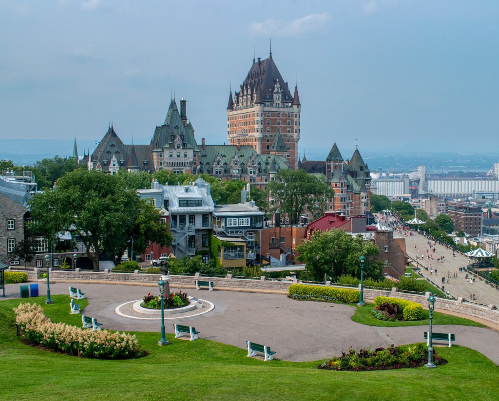
A UNESCO World Heritage Site, Old Quebec combines old world charm, historical significance and geological marvel to enchant the visitor. Situated where the St. Lawrence River narrows (in fact the word ‘Quebec’ was borrowed from an Algonquin word meaning narrow passage or strait) and is dominated by a rocky outcrop (the Cap Diamant) overlooking the river. It is this promontory that made Quebec City such an important defensive position in the battles between France and England in the 17th and 18th centuries.
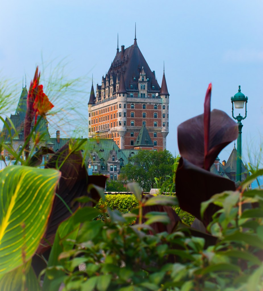
The skyline of Quebec City is dominated by Le Chateau Frontenac, built by the Canadian Pacific Railroad in order to promote rail travel, it was opened in 1893 and was designed to preserve the old world charm of the city. The other major feature of the city is the Citadel, constructed on the Cap Diamant overlooking the city. The modern citadel was built between 1820 and 1850 by the British in order to secure the city against an American invasion. It is currently an active military site, but does offer guided tours which are well worth it.
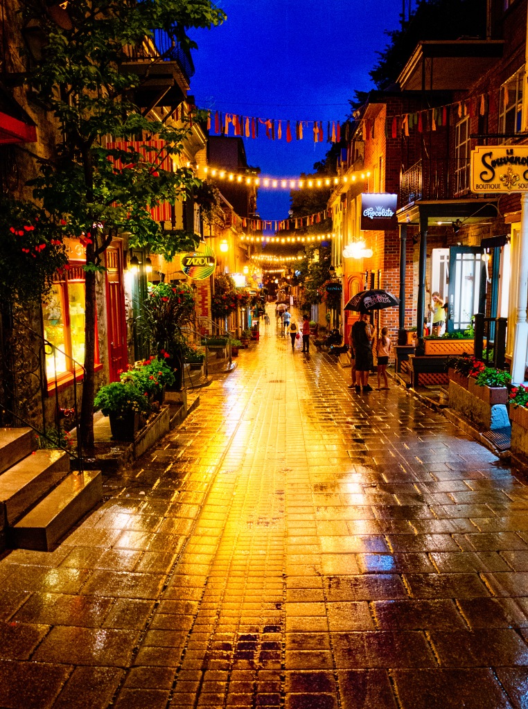
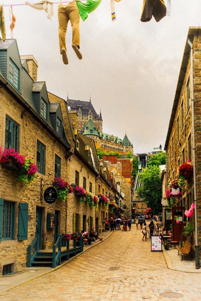
Old Quebec is split into the upper and lower parts, you can either walk between them or take the funicular. For a truly unique stay check out the Auberge Saint Antoine located in the lower city. The Auberge encompasses a trio of historical sites in the Old Port, and during construction a final large scale archeological dig was held that led to the discovery of numerous artifacts, some of which date back to the 1600’s. The hotel is smartly decorated with some of those artifacts artfully displayed and described throughout the hotel. In fact each guest room features its own unique artefact, a tribute to more than three centuries of Quebec history.
Charlevoix
Part I
The second and longer part of the trip was to explore Charlevoix which is about an hour from Quebec City. The region was forged out of the rocky Canadian Shield by a meteor strike 400 million years ago. Rolling terrain, dramatic landscapes, small towns and agriculture have attracted foodies and artists for years. The area is now famous for its agriculture, cuisine, beautiful landscapes and rugged outdoors.
Cap Tourmente and Le Massif

Before arriving in Charlevoix proper we made two stops. The first was at Cap Tourmente (link below), a migratory bird sanctuary between the St. Lawrence river and the Canadian Shield escarpment. The sanctuary is a resting stop for migrating snow geese, when hundreds of thousands of these birds descend on the area for rest and nourishment. It is now a protected area given its importance to this migrating species, and hundreds of other birds (and Monarchs) that call this area home during the summer. The park is very well marked and maintained (good facilities – very important) and easily navigated. There are a variety of hikes depending, both easy and challenging, but be warned that mobile reception is spotty.
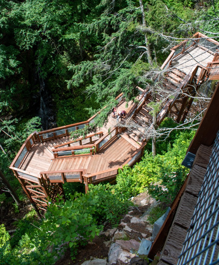
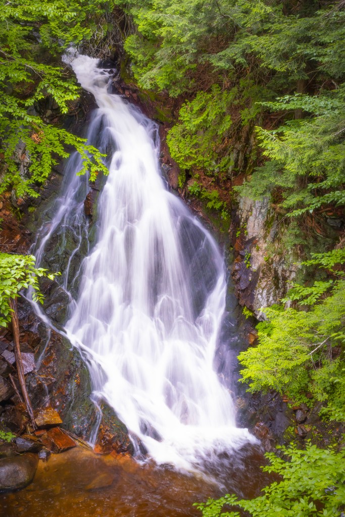
We were here, however, for the hiking, and not along the marshes or flats for bird watching, but up the escarpment looking for the waterfalls. While not a lengthy round trip, only around 7 km’s, the hike was fairly steep (the heat and humidity did not help) and upon reaching the top you are well rewarded with some gorgeous views of the falls. The river follows the steep sided gorge which would normally make it difficult to view the falls, but Parks Canada has constructed some great viewing platforms and stairs (193 steps in all) to view all three levels of the falls. I managed to get some nice shots of the first and the second cascade.
The First Cascade
The Second Cascade

Le Massif
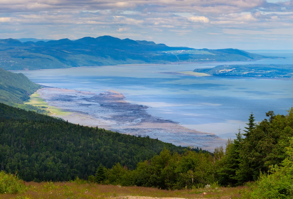
Half way between Cap Tourmente and Charlevoix proper (which starts at Baie St. Paul, is Le Massif – claiming to be the highest vertical drop of all ski hills on the eastern sea board of North America, at over 700 meters. This is where the Canadian Shield meets the St. Lawrence river valley, dropping to the latter in the span of a couple of kilometers. Granted that the skiing must be phenomenal (if not cold) Le Massif is also a very popular mountain biking destination during the summer.
Stay tuned for Part II of Charlevoix.
