
Canmore is often overlooked by tourists in their rush to get to Banff, Lake Louise and Moraine Lake. But don’t overlook this little gem. Not only is it a cheaper and chiller version of Banff. It also makes a great base for exploring the Canadian Rockies. Canmore is quaint; surrounded by gorgeous mountain scenes; it hugs the Bow River, and embodies a gritty, industrial history of mining and the Wild West. I have been to Canmore a number of times, and each time I found that the crowds were reasonable, the restaurants were top-notch, and the views, well what can I say about the views.
The last time I was in Canmore I stayed 4 nights, within easy walking distance of the original ‘downtown”. It was the perfect base of operations. The location was ideal for exploring different sunrise spots for photography. Banff is 20 minutes away, the Icefields Parkway another 40 minutes after that. You can also easily spend a day in Canmore itself as there is a beautiful walking path along Policeman Creek. This path leads you over to the Bow River. From there, you get views of the mountains and Engine Bridge, a testament to the towns industrial history. From there head to the main street for food and shopping.
Now this is by no means a travel blog about Canmore, where to eat or where to stay (you are on your own for that). Rather this blog is an appeal not to overlook this great little town where there seems to be more locals, than tourists. What tourists there are, and judging by the clothing being worn, are serious into backcountry hiking and skiing.
The Engine Bridge
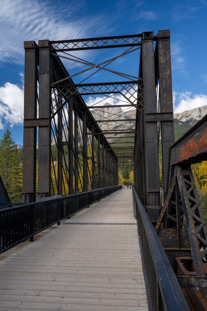
Every town has an origin story, as does Canmore. Founded in 1884 and just two years later coal mining rights were granted by Queen Victoria. For many years the town was a gritty, industrial mining town. In our sanitized world it is hard to imagine the dirt and grime involved with mining coal. Engine Bridge, pictured, was used to transport coal from the seams at the base of the mountains across the river. It has since been converted into a walking and cycling path, connecting the many trails around Canmore. By the way, if it looks familiar it is because it was featured in that popular HBO series “The Last of Us”.
Enjoying this post? Subscribe for more.
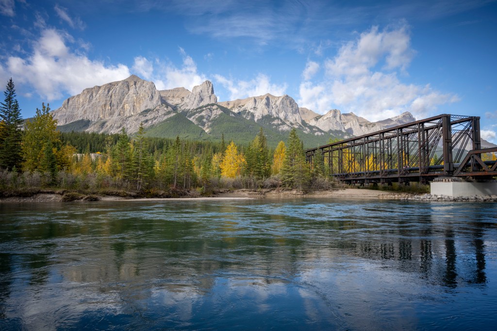
Above is a view of the mountains from Engine Bridge. Starting on the left is Ships Prow. Next is Ehahgay Nakoda (meaning the last human in Stony Nakoda language) – the peak is Mount Lawrence Grassi (in honor of the Italian born coal miner, mountaineer and trail builder). Finally there is Hal Ling peak, until 1997 known as Chinaman’s peak. In 1896, a cook at Canmore’s old Oskaloosa Hotel bet that he could climb the peak in under ten hours. He accomplished the feat in less than six hours and was thus recorded in history. It was a sign of the times that his name was not originally recorded, only his race; this was properly corrected in 1997.
On Line Gallery
Looking for memories of your time in Canmore? Well take some home. Prints of images in this blog are available from my on-line gallery through Pictorem.
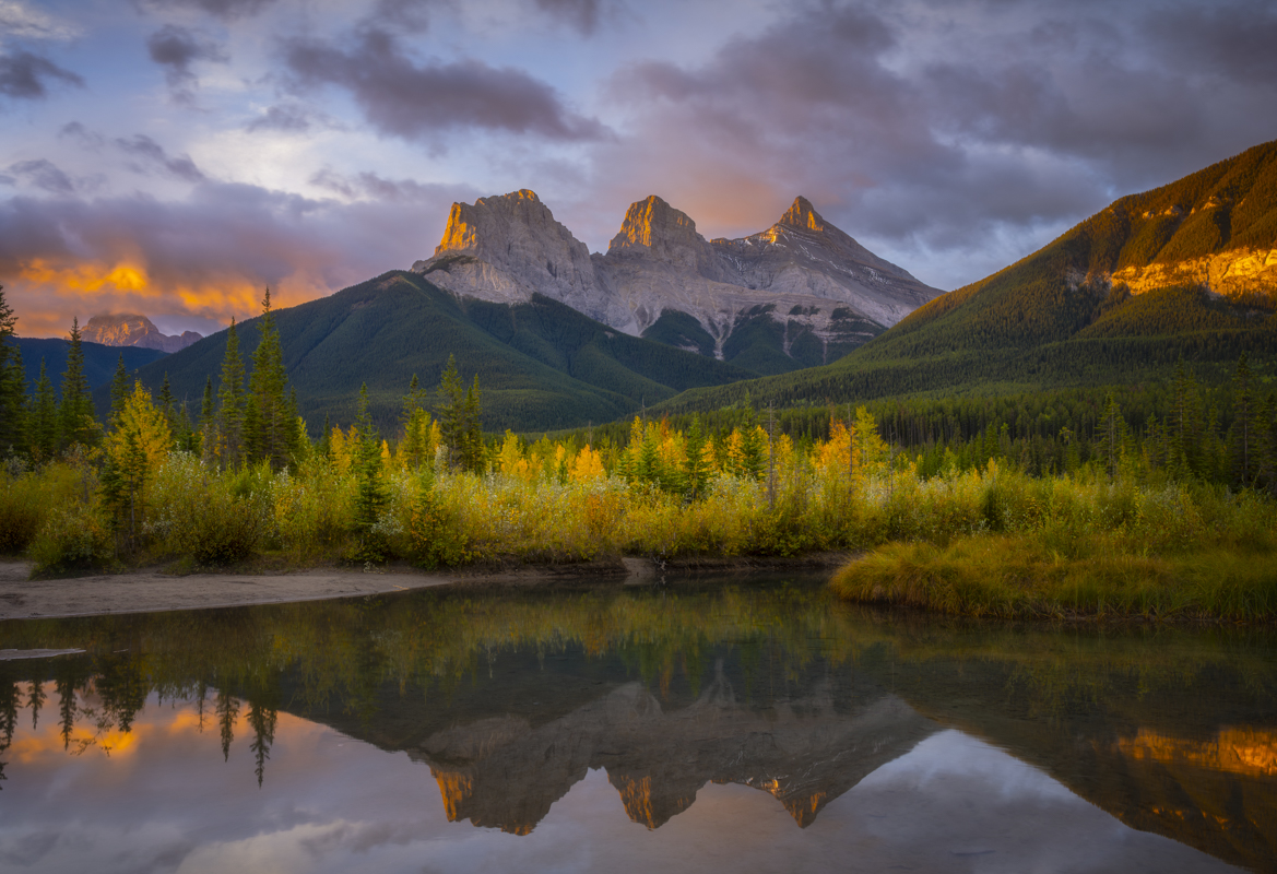
Sunrise Photography
(click on the images below for a bigger view)
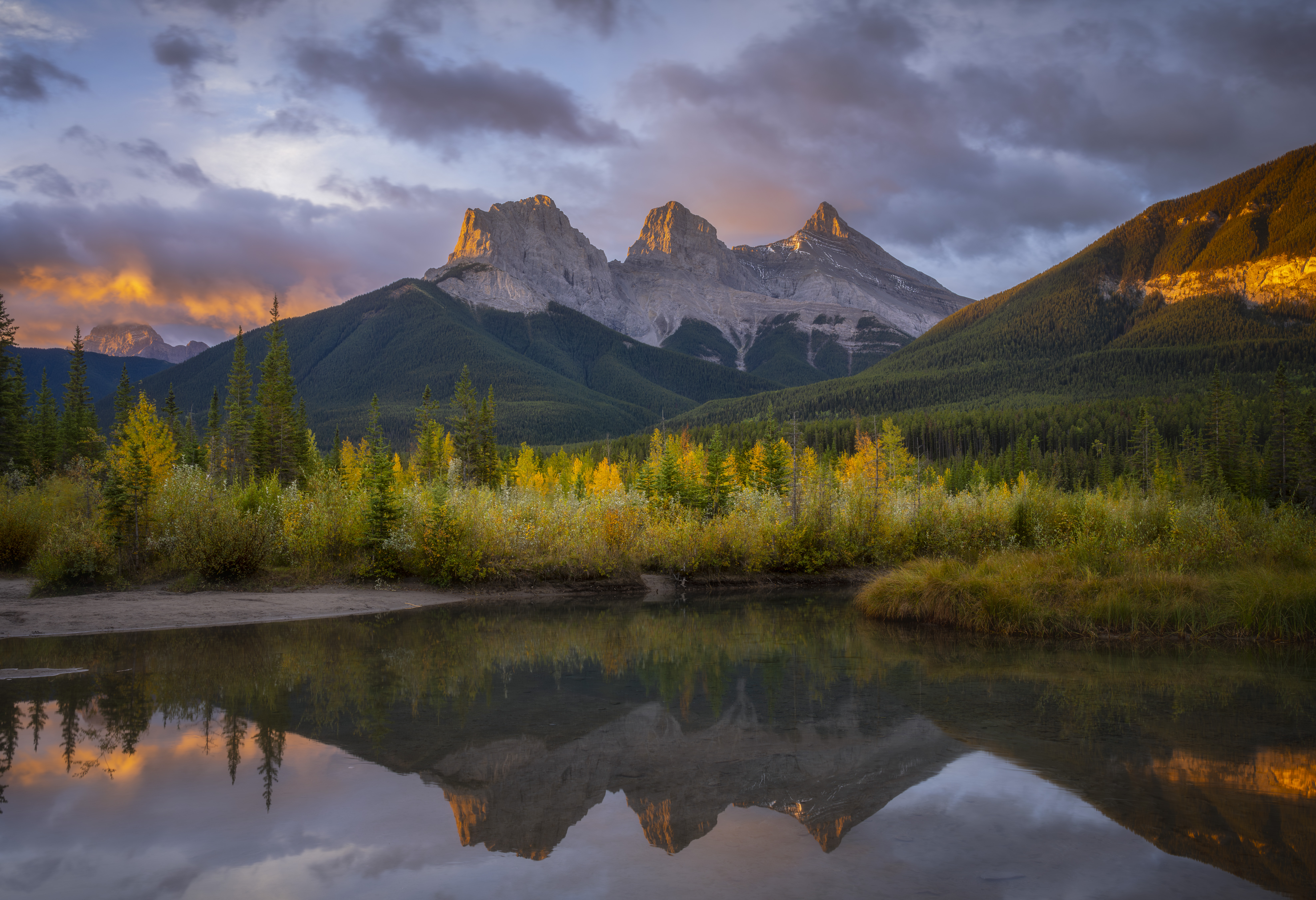

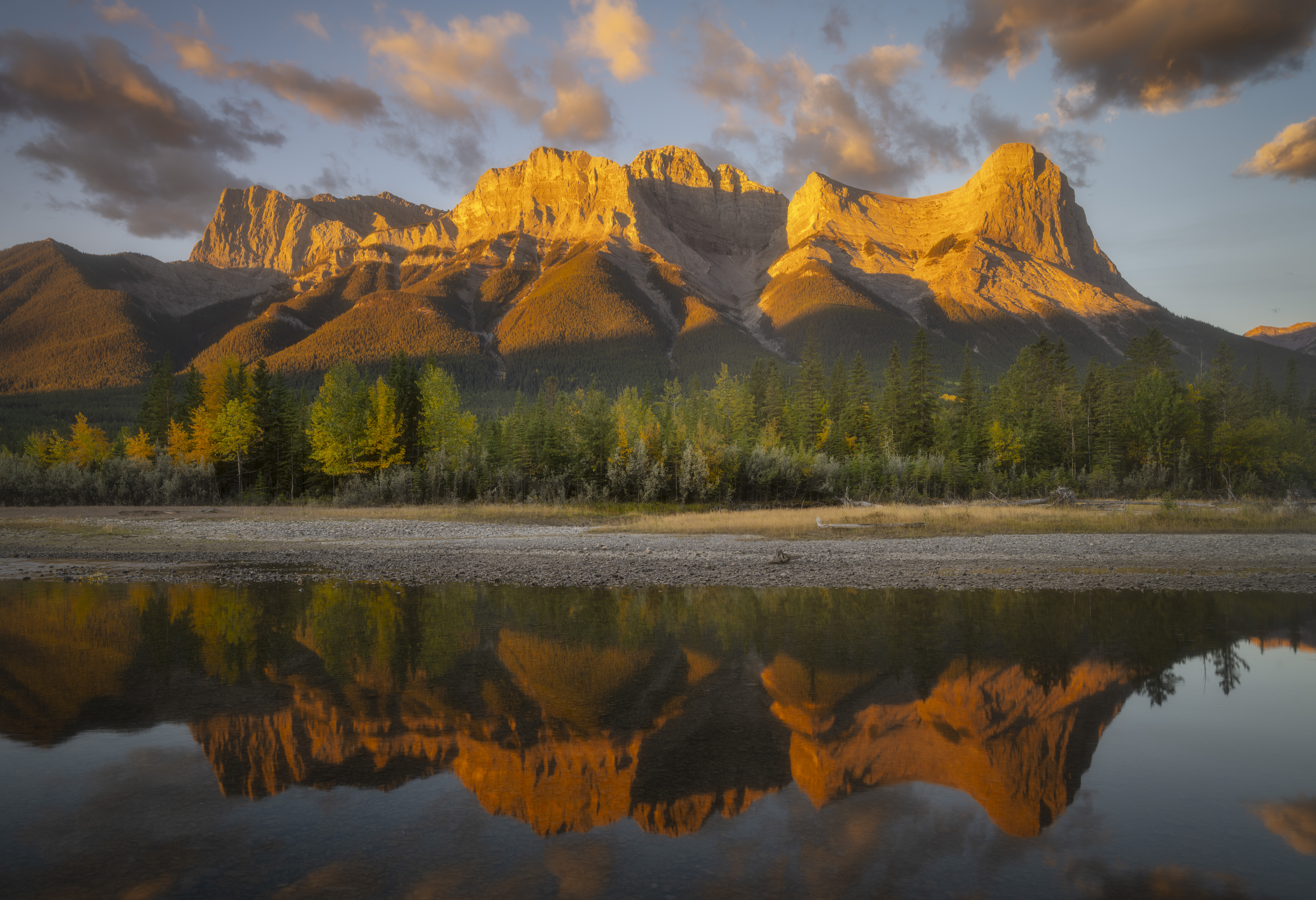
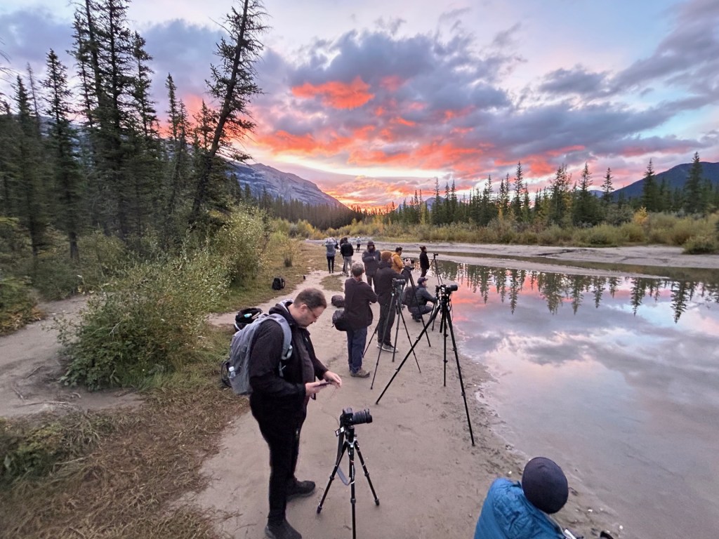
There are numerous locations around Canmore for sunrise photography. The most popular would be a view of the Three Sisters from the shores of Policeman Creek, check out my blog here for details. But beware this is a popular location as shown on the right. This is one of the best locations to get a shot of the Three Sisters with a reflection in the water.
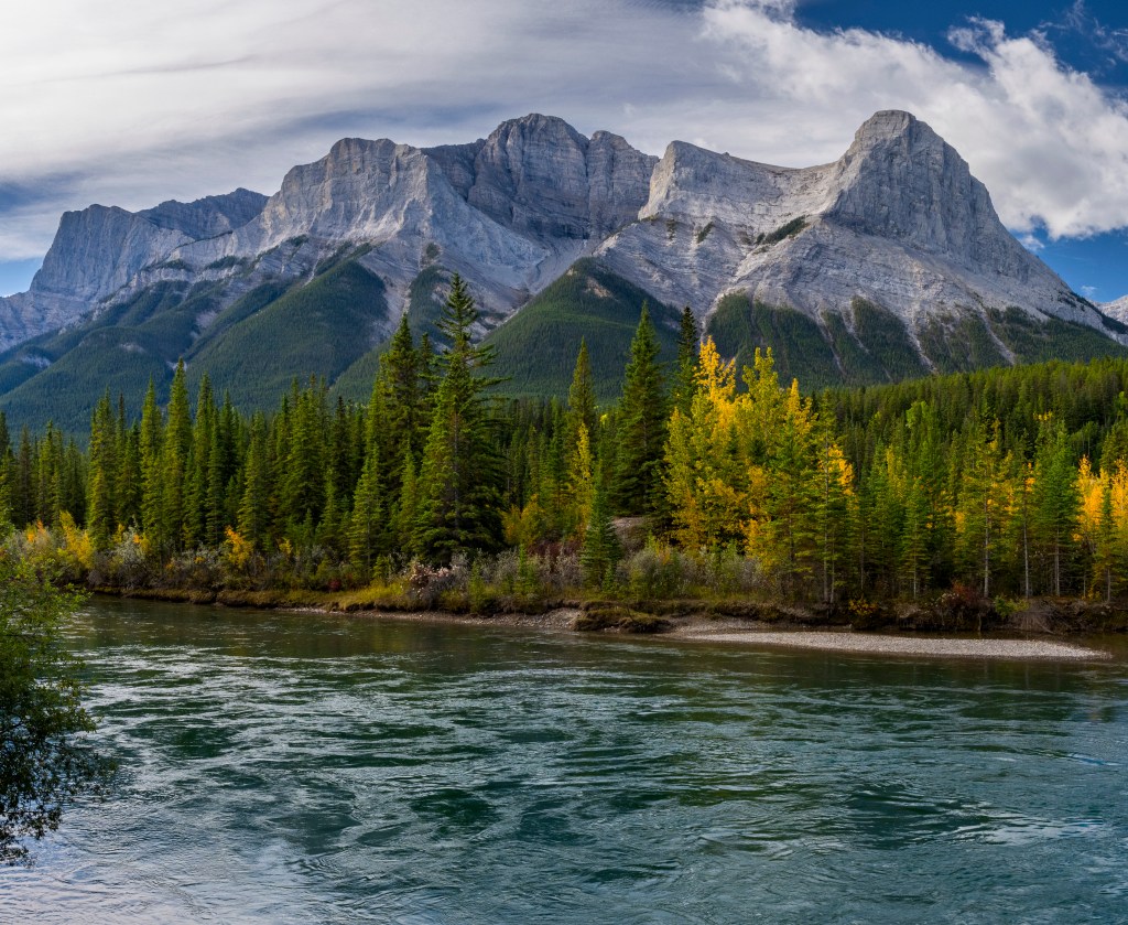
The other two photos above were taken from the shores of Quarry Lake, and from a spot on the shores of the Bow River. Both are no more than a ten minute drive from downtown Canmore, and as a bonus you may see some wildlife on the way (bring bear spray).
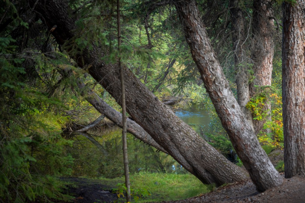
Walking Around
The trail that follows Policemen Creek is just a joy. You will come across many locals walking their dogs, while soaking in tremendous views of the mountains through the trees. Hungry? Thirsty? No worries since there are plenty of cafes or brew pubs to quench your needs. The trail traverses all of Canmore (north to south), and it does connect to the Bow River trail system for a view of the mountains and Engine Bridge.


One thought on “Exploring Canmore: Your Base for the Canadian Rockies”