

Baie Saint Paul
Marking the start of the Charlevoix region, the charming village of Baie Saint Paul is a popular destination for tourists. The main street is lined with galleries featuring local artists, and numerous restaurants featuring local produce. We arrived at the village mid-afternoon after having hiked in Cap Tourmente all morning, and we were famished. Initially we were faced with lengthy line ups to gain entry to the eateries, which was not helping my hangry state of mind, but luckily we did manage to get seated at a very nice establishment with an interesting menu.
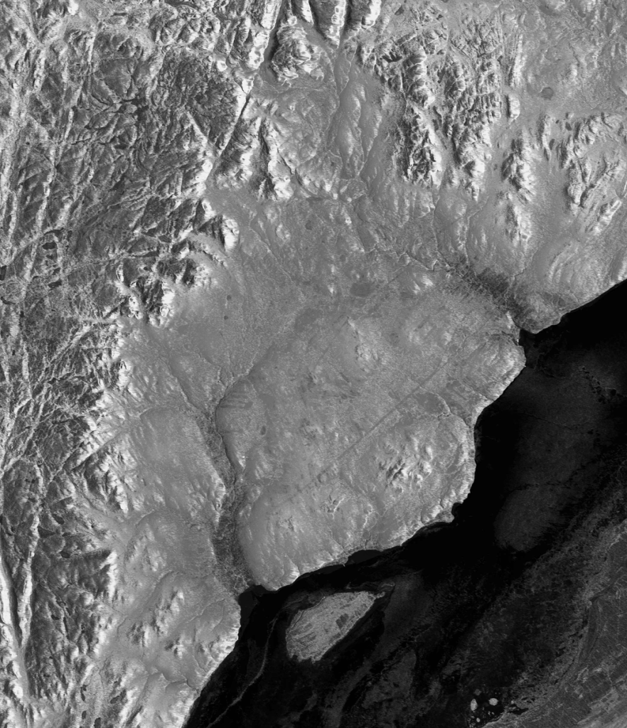
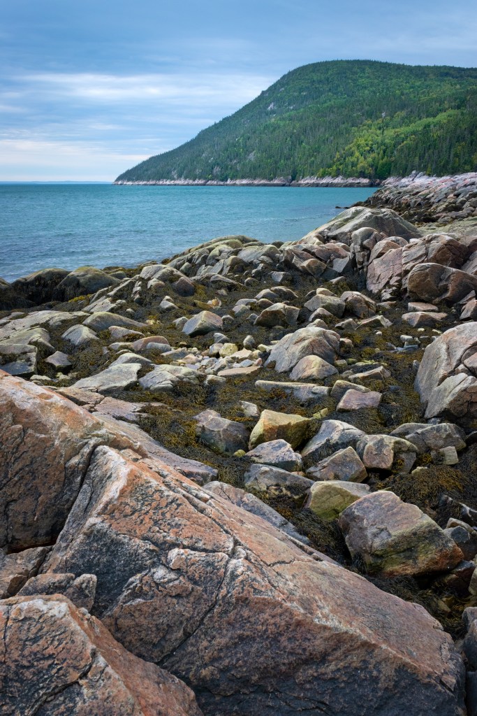
What makes the Charlevoix region different from the rest of the Canadian Shield, was the result of a meteor impact which occurred approximately 400 million years ago. The impact smoothed out the craggy mountains of the Laurentians, leaving the region ripe for agriculture, but still very, very hilly.
Les Eboulements
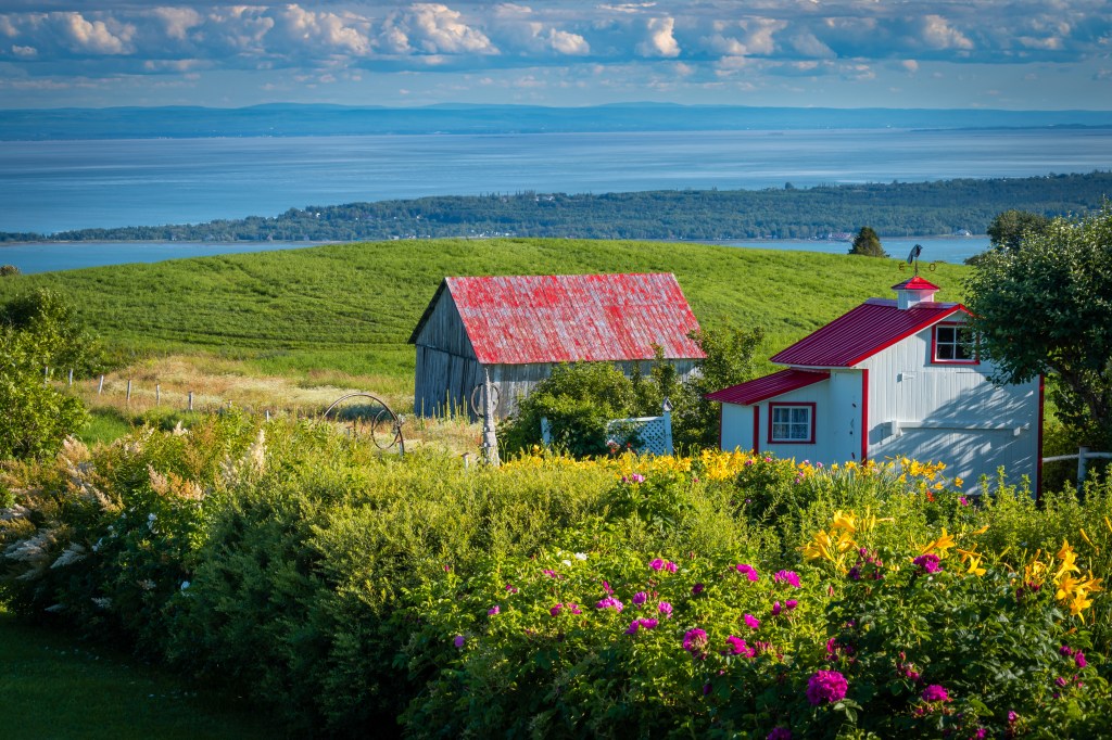
We took the scenic route after leaving Baie Saint Paul, following the coastline through the picturesque villages. This is where rocky Canadian Shield plummets into the river, creating spectacular views and white knuckle drives as the road follows the contours of the escarpment. Les Eboulements is one such village, once a small farming village, it now attracts tourists and supports a vibrant arts community. Eventually we made our way to La Malbaie and the famous Manoir Richelieu, our home for the next four nights. We used the Manoir as a base to explore the region, and do some hiking in the National Parks run by SEPAQ, Quebec’s Provincial Park authority. https://www.fairmont.com/richelieu-charlevoix/
The story of how La MalBaie, which translated means ‘The Bad Bay’, got this name dates back to Jacques Cartier, one of the first to explore the region, who wanted to set anchor in the bay, but discovered that during low tide the water was far too shallow.
One warning about La Malbaie – while charming, restaurants are limited (made worse with COVID), typically with one seating during the evening, and given the number of tourists visiting, meant having to reserve spots days in advance.
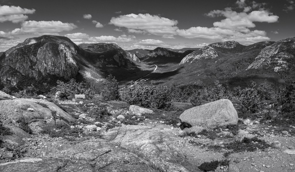
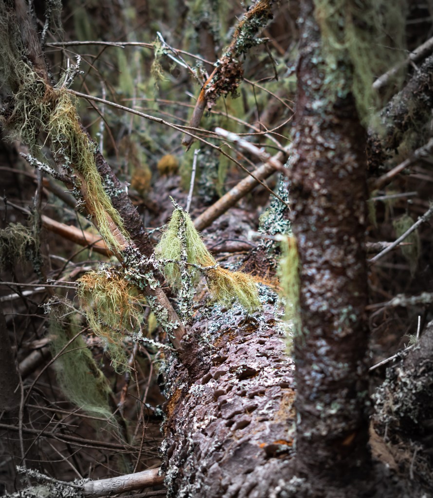
Parc National des Grand-Jardins
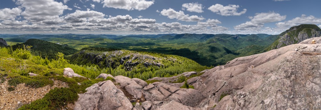
Our first hike in the region was a park named Parc National des Grands-Jardins, link below. We elected to hike the La Chouenne trail, a 5km out and back hike climbing 250 meters to the peak. The more popular hike is the Mont du Lac-des-Cygnes trail, which at 9km and 500 meters of climbing was more than we wanted to tackle.
Tadoussac
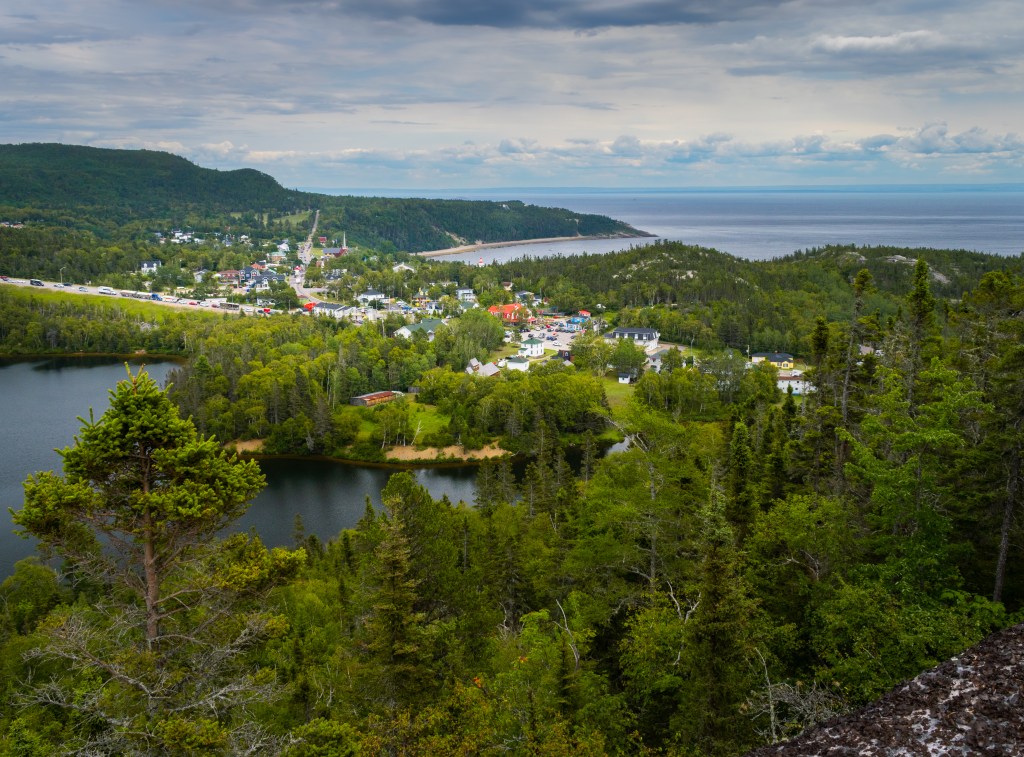
Not originally on our itinerary but a great suggestion by hotel staff, we ventured north to the tiny village of Tadoussac, home to about 800 souls, and currently a very popular tourist site, especially for the whale watching. Founded at the confluence of the Saguenay Fjord and the St. Lawrence the site was originally settled by the First Nations Innu for hunting a fishing. Later, in the 17th century, European whalers and traders adopted the natural harbor and abundant waters.
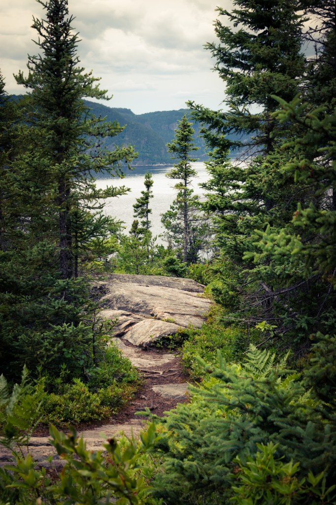
Reaching Tadoussac means crossing the Saguenay River by ferry which was an adventure in itself. The ferry ride itself takes about 15 minutes, but loading and unloading of the boats can take about the same amount of time. You can count on 45 minutes to an hour depending on the time of day that you arrive. https://tadoussac.com/en/

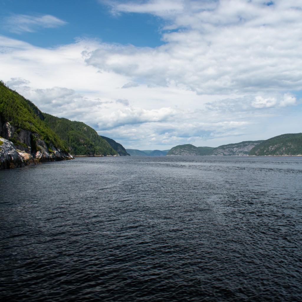
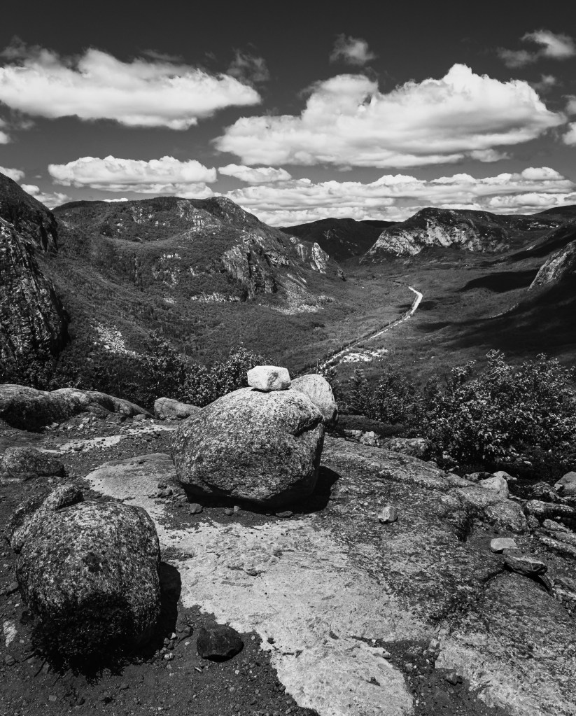
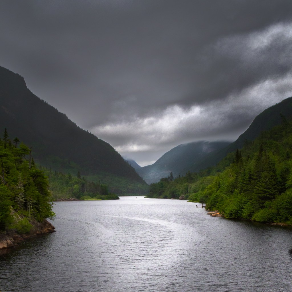
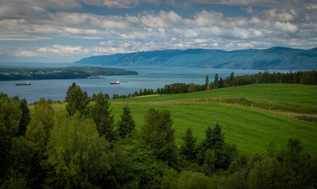
The Saguenay fjord is about 100km’s long, starting at Lac St. Jean until it reaches the St. Lawrence River. It is this confluence which is so attractive to numerous whale species who feed in the warmer waters. The whole region is one outdoor attraction from whale watching, river kayaking, hiking and backpacking. Upon arriving on the opposite shore, we ventured on a 5km hike with very nice views of the fjord and the town of Tadoussac (pictured above).
The village of Tadoussac is tiny and very quaint if not overrun with tourists. Once again we were challenged to find nourishment as every establishment seems to have a line up out side the door. We ended up just picking up a take out lunch from the grocery store and eating at a park bench overlooking the river, at least until it started raining.
For information on the national park of the fjord, click here; https://www.sepaq.com/pq/sag/index.dot?language_id=1
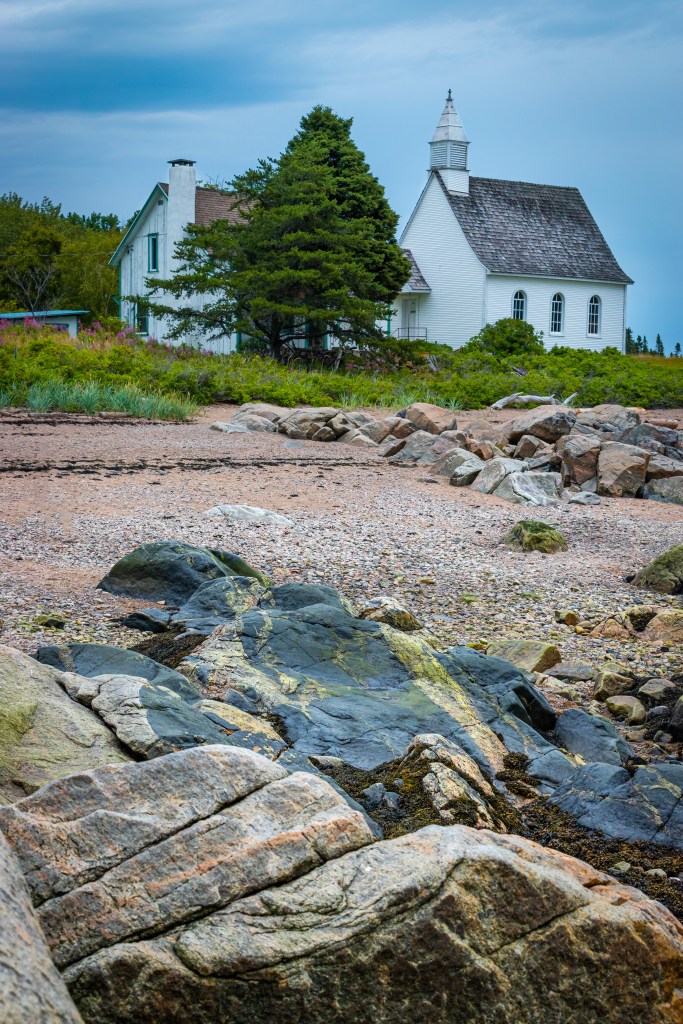
Port-au-Persil
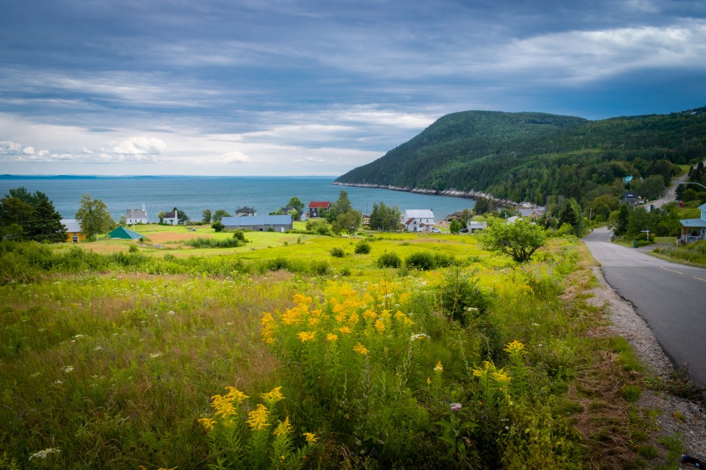
On our way back to La Malbaie, we stopped in at Port-au-Persil, a small coastal village of less than 100 inhabitants. The town was founded by Scottish immigrant, Neil McLaren whose sons built the small white chapel situated close to the rocks. The small towns livelihood was based on repairing whaling and other vessels in it’s natural harbor. Now, there is no active industry and residents just enjoy the natural beauty and isolation.
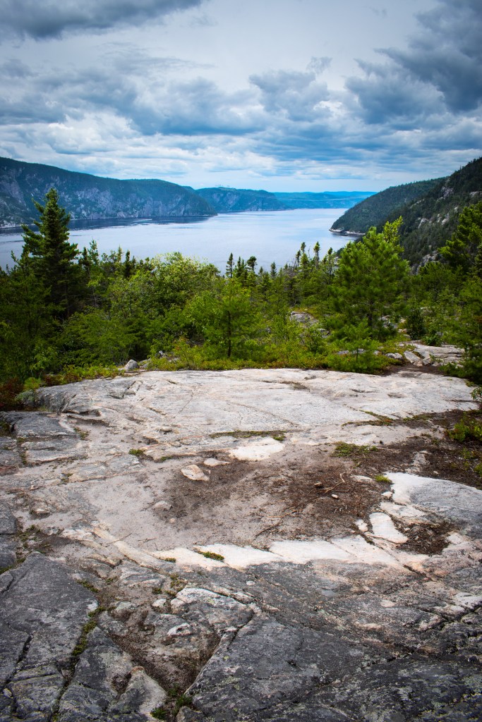
Les Hautes Gorge
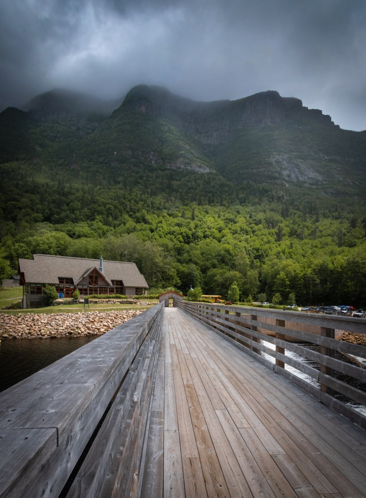
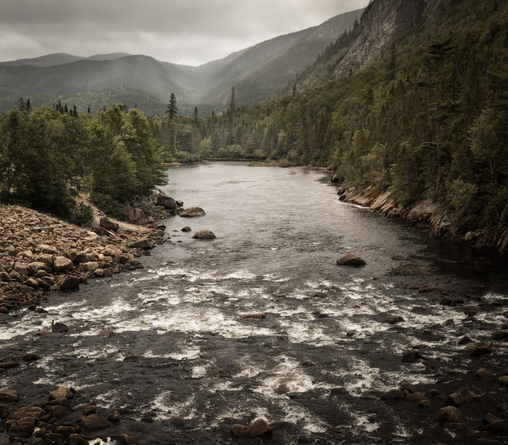
Our last day for hiking in Charlevoix we headed to Parc national des Hautes-Gorges-de-la-riviere-LaMalbaie. Located about 50 minutes from La Malbaie, this is a relatively new park in the SEPAQ network. Originally a logging camp, it has now been converted to a national park, and it is not for the faint of heart. This park features what is described as the toughest hike in all of the national parks in Quebec. The Acropolis is an 11.2 km long hike with an elevation gain of 800 meters, and as you ascend the environment changes to artic-alpine (in other words – cold). We did not attempt this hike, choosing rather some of the hikes available at the lodge, pictured below which featured a hot lunch and impeccable rest rooms!

Happy Travelling!

Beautiful pictures. I was once at Les Hautes Gorges De La Rivière Malbaie, on the Acropolis. I can attest to “as you ascend the environment changes to artic-alpine”. It was in July with a warm 30C when I started the hike and when I reached the top there were snow flurries. This was one of the most difficult hikes I ever undertook.
LikeLiked by 1 person