
A Photographic and Hiking Adventure
Introduction
Nine days in the Canadian Rockies; and I ask myself “was it enough time?” Well, the answer to that is both yes and no (how’s that for being Canadian!). Yes, since this was my first time in the Rockies and I was completely overwhelmed by the majesty and the scenery (it has taken me four months to review and process all of my images); and No because there is just so much more to explore and photograph! The Canadian Rockies are a very popular tourist destination, and there is a reason why; the landscape is simply spectacular and to put it bluntly, ‘in your face’.
Prints
Prints of images in this blog are, or can be made available, in my on-line gallery through Pictorem here. Pictorem is a professional printer who offer a variety of media including Canvas, Acrylic, Wood and Metal substrates for printing and most importantly a money back guarantee.
Why you should read this post?
If you have never been to the Canadian Rockies, and you are into photography this post should give you a good overview of the region; where to hike, what to target and what to do? We are not overnight hikers, so we selected hikes which were moderate in length (less than 10km in length) and relatively close to hotels and restaurants.
Weather
The weather in the Rockies is dynamic. On the afternoon we arrived in Kananaskis, a storm front was passing through, which meant rain, wind and cold(ish) conditions. By the time we checked into the hotel, we were sitting on the balcony basking in sunshine and clear conditions.
We were there during the last week of June and so you would expect that summer conditions had arrived; but on the second day temperatures plummeted (so much for basking in sunshine on the balcony) and were close freezing, it was very windy, and to our appreciation, it started snowing. During the snow storm Jasper got over 30cms of snow on the ground. While dreaded, that snow actually made for better photography since the snow added contrast and depth to the mountain peaks.
Hint: Pack for your expected conditions, but also bring along some warm clothing. We brought a lot of layers (base, wicking, thermal and warm jackets – plus a rain jacket on top).
Bears
Warning: There are bears in the Canadian Rockies and they can be dangerous.
Really? Is it that dangerous? During our nine days in the Rockies, we saw two Black Bears while we were on the highway and driving by in the car. We never saw or heard any bears on any of the hikes we did, but that does not mean you shouldn’t be careful and prepared. The recommendation is to bring Bear Spray (which is really a super-grade of pepper spray). You can either purchase one or rent (we opted to rent for a couple of hikes as it ended up being slightly cheaper).
Popularity
Banff, Lake Louise and Moraine Lake are VERY popular destinations. Banff can get very busy so you need to book your hotels early. When you are visiting downtown Banff, your best option for parking if you need it, is to park next to the train station (free) and walk into town (less than 1km).
Restaurants were very busy, but we were not picky and essentially went to whatever was available so we did not have any issues. However, if you have a particular restaurant in mind, reserve early.
Lake Louise is super busy – and at times only accessible via the shuttle bus from Lake Louise Village. The only option to access the Lake by car, is if you have a hotel booked at Lake Louise (which is either the Fairmont Lake Louise or the Deer Lodge). For sunrise and sunset photography the best option is to book one of those hotels around the lake. That will give you easy access to the Lake, before the crowds and in time for sunrise. Past Golden hour in the morning, the winds pick up and you loose that smooth lake surface (and the good light).
You can no longer drive into Moraine Lake (unless you have a hotel reservation at the lake) and therefore you need to reserve a shuttle. There are a number of options available from Parks Canada, many private shuttle services or from the Fairmont Lake Louise (but you need to be a registered guest there). More info here.
Photography
While I will be recommending many popular spots for photography, the thing to remember is to make this your own trip. Explore and find your own compositions, your own locations. The Rockies have been photographed countless times – try to make your images unique by finding different compositions and angles – but also working with the lighting and the weather at that time. I took hundreds of pictures in Kananaskis, in rain, fog and bright sunshine, with the goal of finding something unique. The weather plays a huge role in what kind of images you can create.
If you are enjoying this post and would like to get notifications about future posts, subscribe here.
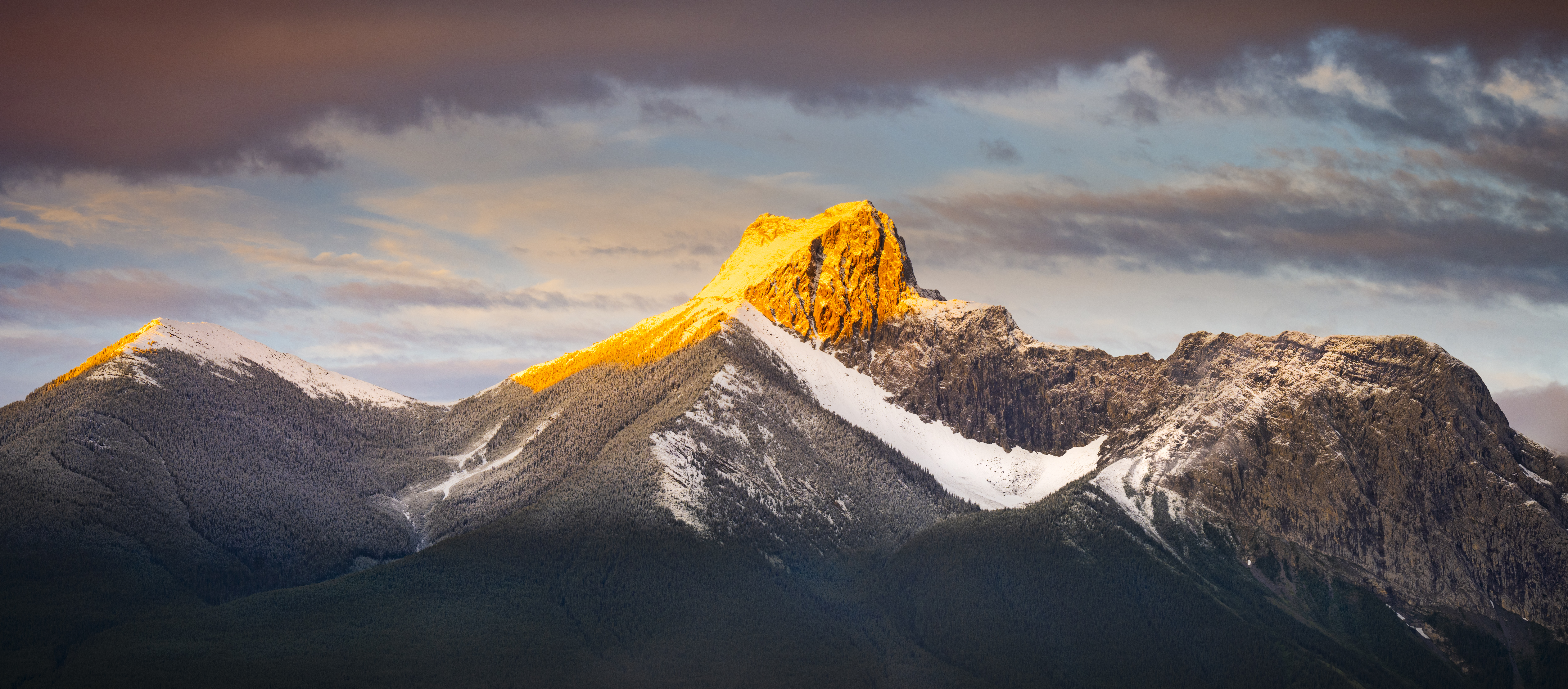
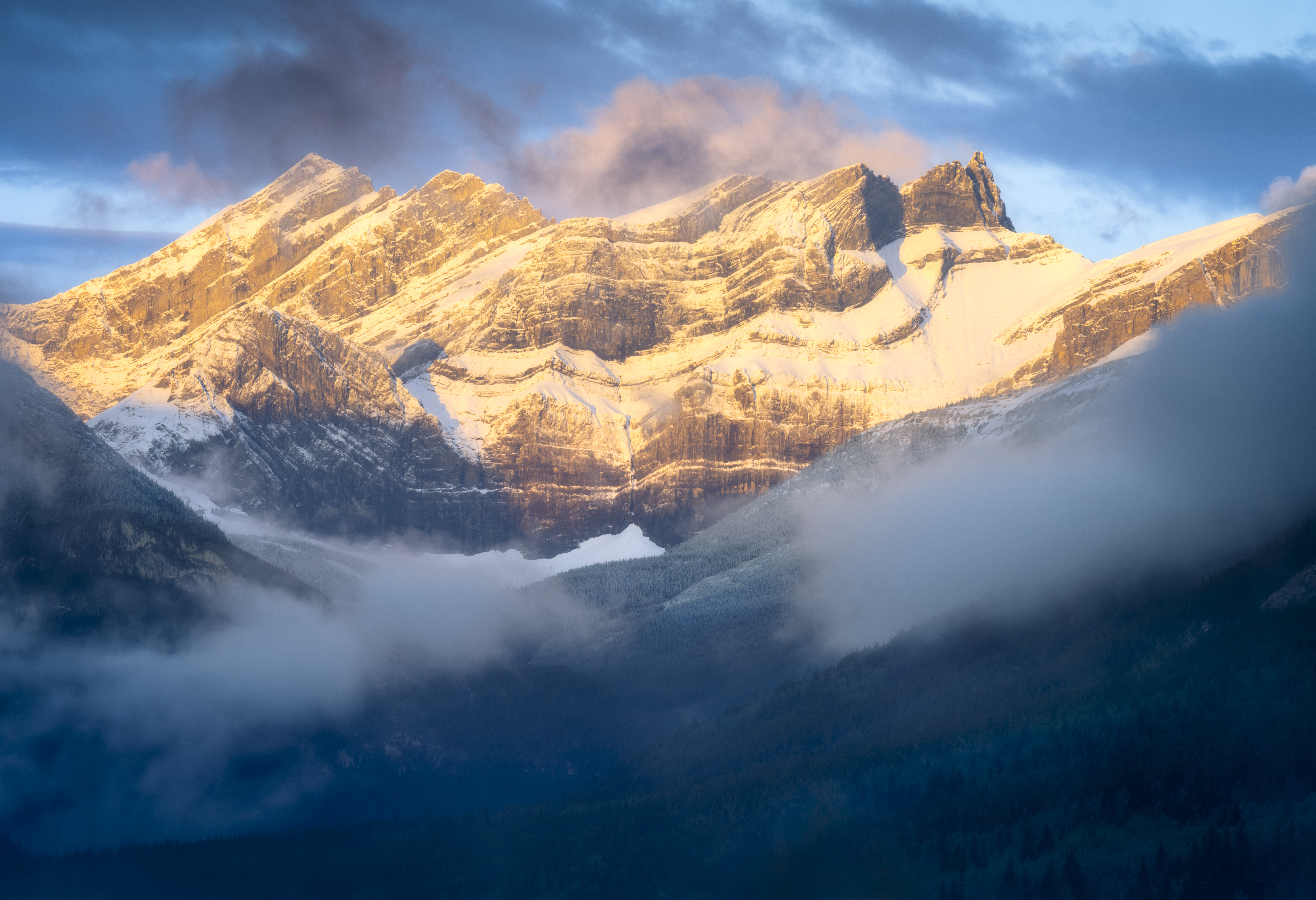
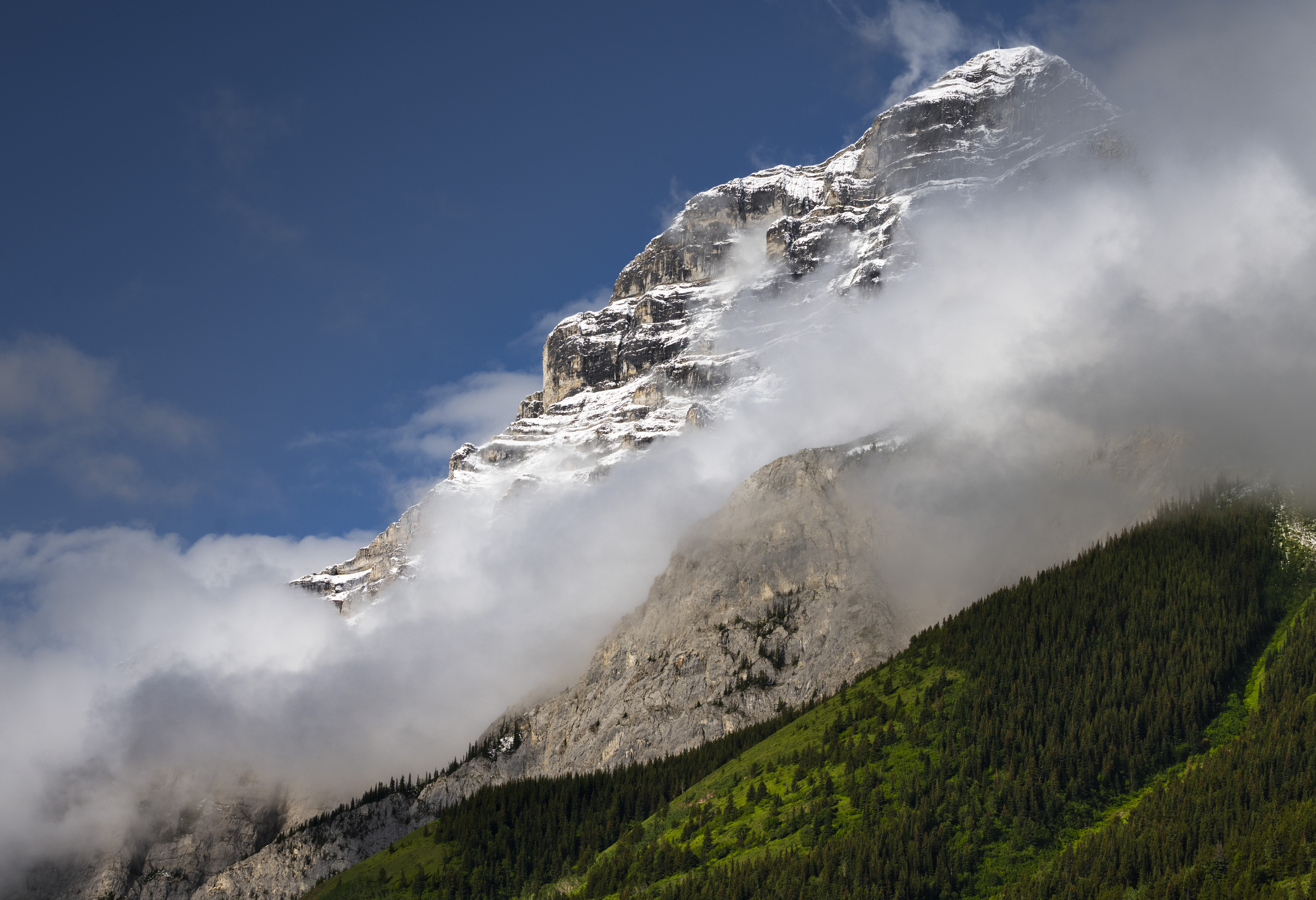
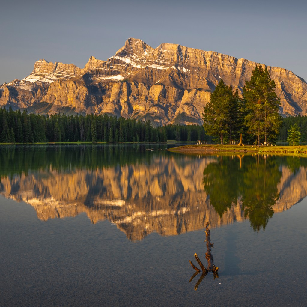
Kananaskis Country
While Banff, Jasper and Glacier National Parks get all of the attention (and justifiably so), Kananaskis Provincial Park is the forgotten cousin of these national treasures. However that is by design and Kananaskis is by no means less spectacular than all of the others. The goal of the park, when it was created, was to limit commercial development and preserve the natural beauty of the area, and as a result services such as restaurants, hotels and gas stations are almost non-existent. For much more information about Kananaskis click here.
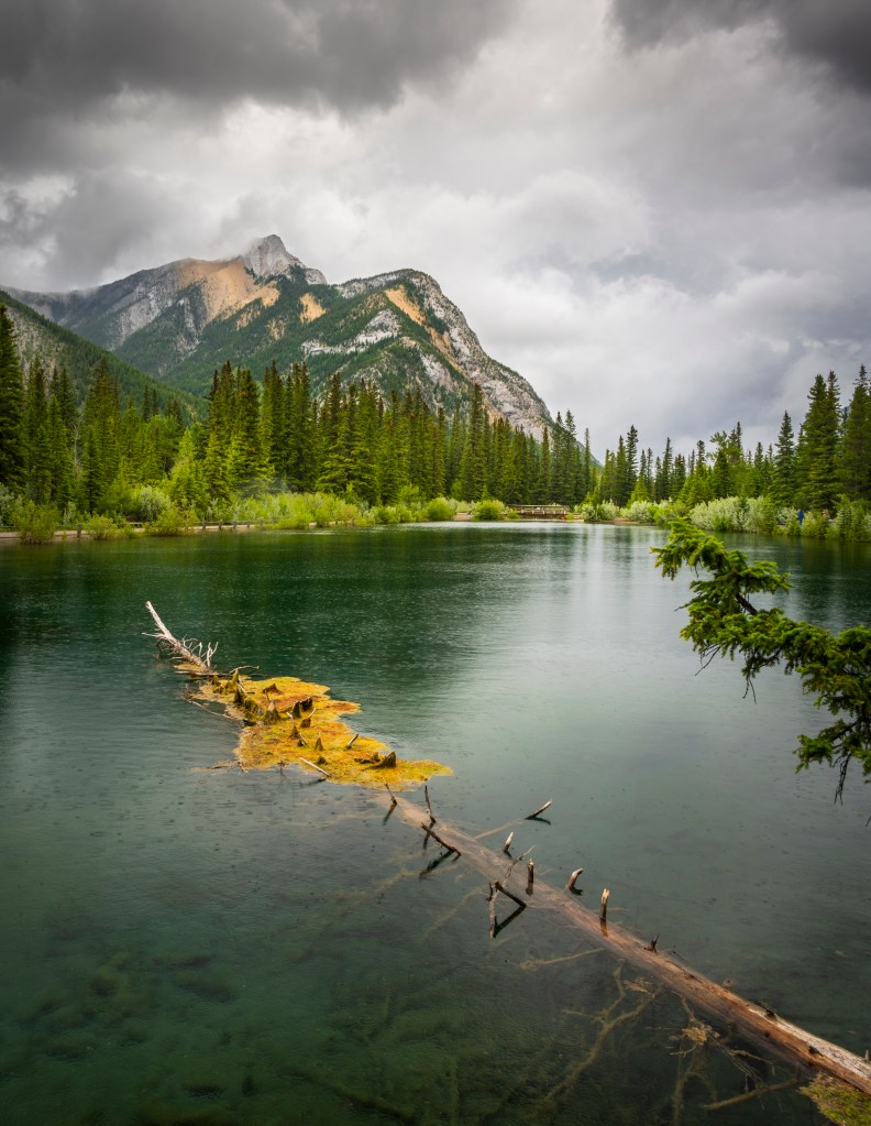
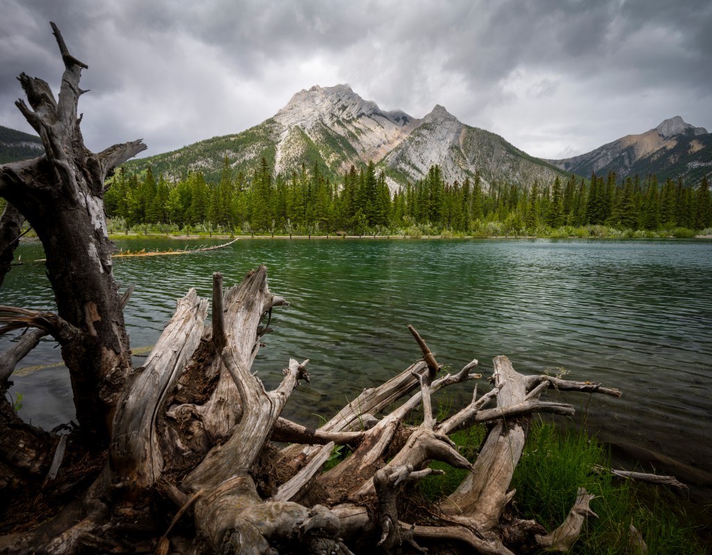
Mount Lorette Ponds
Kananaskis Provincial Park is about one hour from Calgary and Mount Lorette Ponds is one of the first areas to explore before reaching Kananaskis Village (where our hotel was located.) The walk is very reasonable, at most 2 km’s and very flat. The area offers multiple view points and compositions with emerald ponds, crystal clear water and mountainous backgrounds. I would say the Ponds offer more and better compositional possibilities than Wedge Pond (described below), but that could have been the weather I had at Wedge Pond the next morning influencing my opinion.

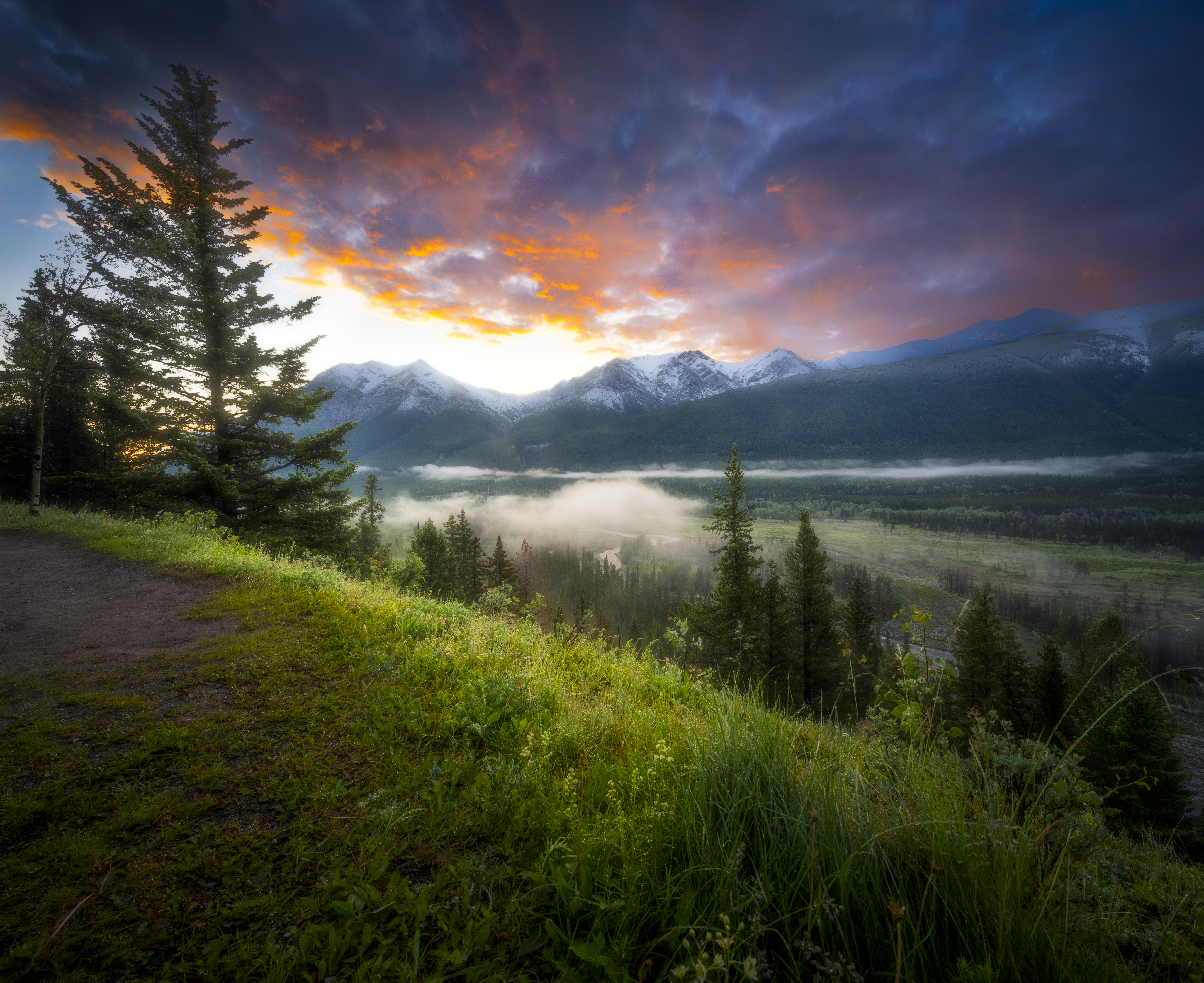
Village Rim Walk
Kananaskis Village (which is really the Pomeroy Marriott Hotel) is located where the mountains of Kananaskis really start. The Village Rim Walk is a 2km walk that overlooks the valley and the mountains beyond. There are countless view points and compositions all depending on the weather conditions at the time. Most of the images in the gallery below were taken on our last day there, the weather had cleared, there was a gorgeous sunrise and plenty of dew and fog from all of the rain and snow to make things interesting.

Wedge Pond
If you are reading various blog posts about photographic spots they will mention Wedge Pond as a must do location. The pond itself is okay, with a view of Mount Kidd to the west. The best location for photography is on the East shore (the farthest from the highway) looking West towards Mount Kidd. It could have been the weather (bitter winds coming in from the North together with rain and snow – I was freezing despite all of my layers) and the lack of an interesting sunrise, but I was not impressed with the location. But I have seen some gorgeous shots from the area, so…. conditions are everything and it is worth giving it a shot!
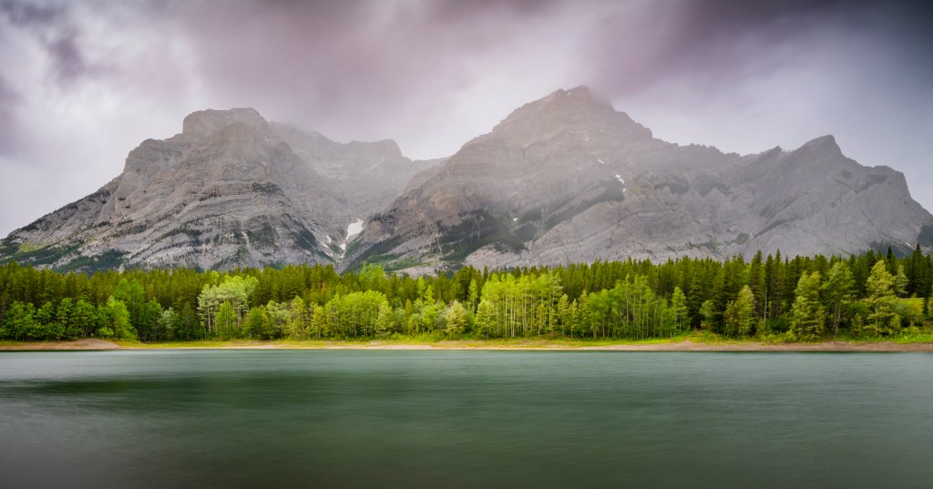
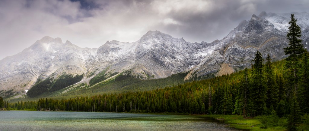
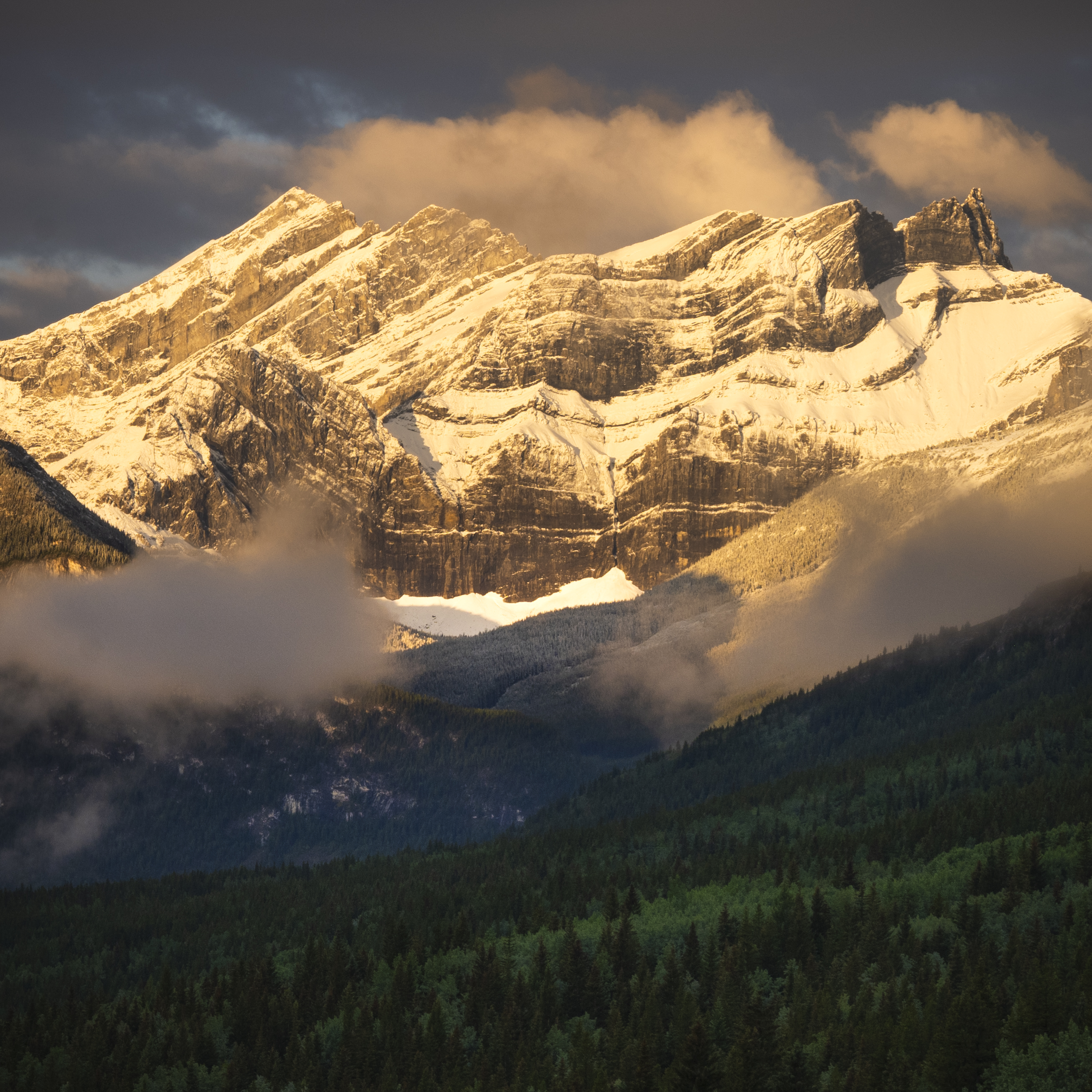
Elbow Lake
Given the deteriorating weather conditions on our first day, we opted for a shorter hike than originally intended and it worked out fantastic. Elbow Lake is a 5-7km hike which starts with a roughly 1km climb from the parking lot, levels out and eventually reaches the lake. The route around the lake is about 2km and flat with spectacular views of the surrounding mountains (check out the panorama at the top of this post, which is your first view as soon as you see the lake), definitely worth it.

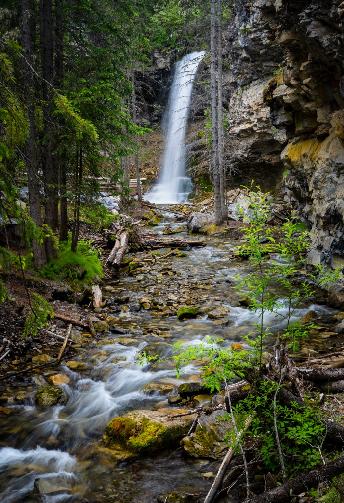
Troll Falls
The Troll Falls Hike trailhead is located 5 minutes by car from Kananaskis Village and is an easy hike through pine forests on a well maintained path. I was somewhat disappointed with the location for photography since there are numerous railings and guard rails restricting access to desired compositions. The falls are very nice, and perhaps with fall colors, and different lighting better images can be captured. Given it’s proximity to the village and brevity, it is definitely worth checking out.
Canmore
Before reaching Banff National Park, you will come across the village of Canmore, Alberta and it is definitely worth a stop (and a stay). Canmore owes its existence to coal, that much-maligned fossil fuel that ‘fueled’ the industrial revolution. Back in the mid-1800’s it was the energy source du-jour and when veins of coal were discovered in the Rockies, mining licenses were granted, companies founded, and the tiny, rough mining town of Canmore was founded. However that should not take away from the scenery or the charm that Canmore now offers. Less crowded and less expensive than Banff, Canmore offers great dining, hospitality, and amazing scenery.
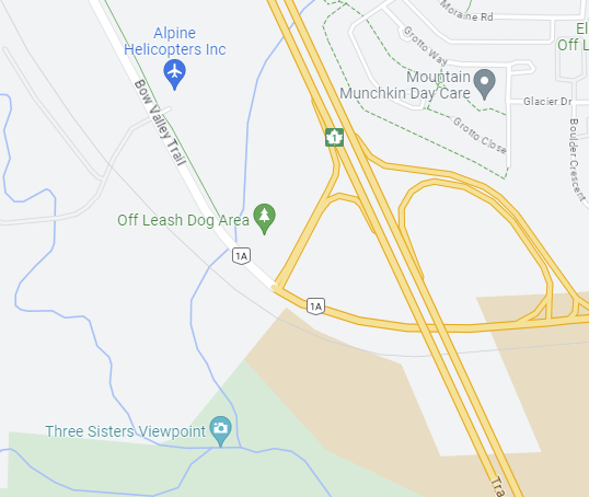
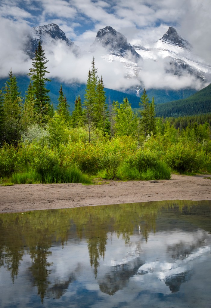
The Three Sisters
One of the most touted and photographed scenes in Canmore are the Three Sisters, three mountain peaks just south of the town. The best location for photography is on the banks of Policemen’s Creek, at a particular spot just outside of town. Be warned that it is a bit of a trek to get there; just google the Off Leash Dog Area at the junction of the Trans Canada Hwy and Hwy 1A. Next to the parking is a creek (with a much larger area called a wash). Carefully make your way across Hwy 1A, and follow the wash until you reach Policeman’s Creek (keeping the wash on your left – you will eventually find some foot paths through the forest). It sounds like an odd way to get there, but there are nice reflections of the peaks in the creek. This is a definite must at sunrise as the peaks will be illuminated from the side.
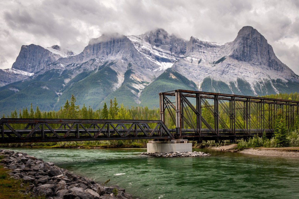
The Old Engine Bridge
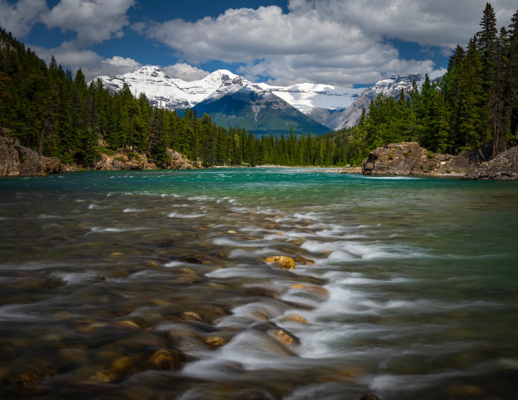
Another very popular location is the old Engine Bridge which crosses the Bow River. This steel girder structure, which has since been converted into a pedestrian and bike path, was once used to transport coal from the mines in the mountains, to the CP rail yards. The backdrop of mountains, the emerald green Bow River and the bridge all combine for interesting compositions. The view of Mount Rundle as it stretches all the way to Banff is a sight to behold.
Quarry Lake Park
For great views of the Eastern range of Mount Rundle head either to the Rundle Forebay (a reservoir), or Quarry Lake Park; both of which are on the other side of the Trans-Canada Hwy from Canmore. Both offer great views of the mountains, work very well as sunrise locations, and can feature nice mountain reflections in the water.


Banff National Park
Canada’s first national park, Banff National Park encompasses rocky mountains, emerald lakes, and countless raging rivers – there is no wonder why Banff is a UNESCO World Heritage Site. To access the park you will need a park pass – available here. The starting point for most visitors is the town of Banff, which is definitely a great place to begin your journey. We spent three full days around the town and it’s surroundings and had a great time.
Banff
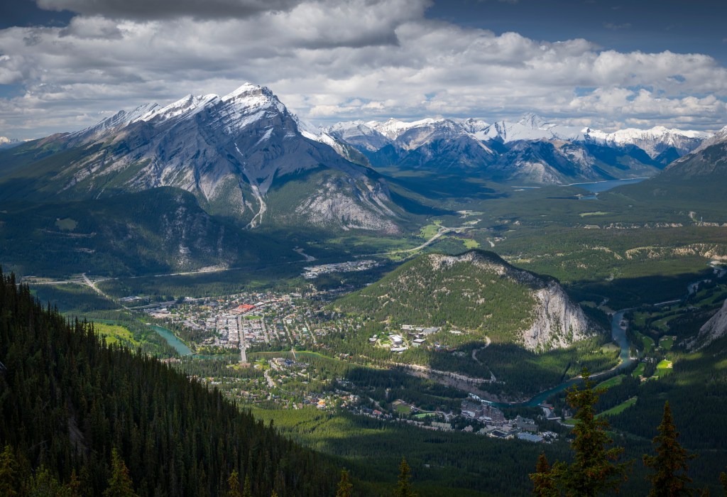
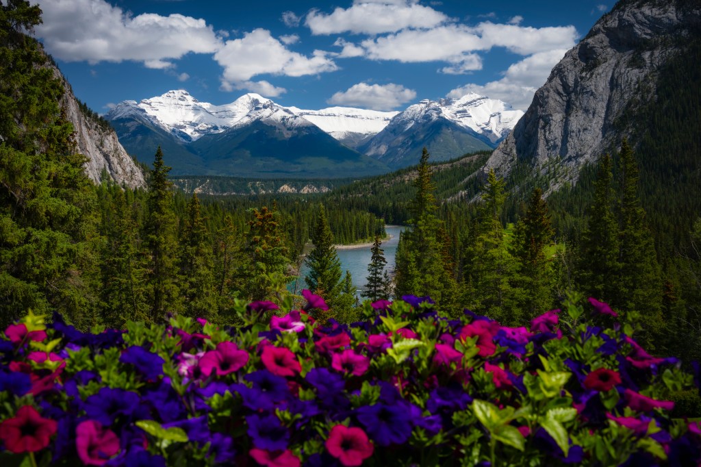
The 25km drive from Canmore to the town of Banff is one jaw dropping view after another. The town itself is surrounded by mountains on all sides, including Tunnel Mountain situated right next to the city center. There are many different activities available which can be found here. Photographic recommendations are the Cave and Basin Museum, Surprise Corner (and the hoodoos further on), Bow Falls, Two Jack Lake, Lake Minnewanka (great for hiking and views), the Banff Springs Hotel (for lunch or dinner – just to say you did it) and the Sulphur Mountain gondola ride (and ridge top hike – definitely a must).
Surprise Corner
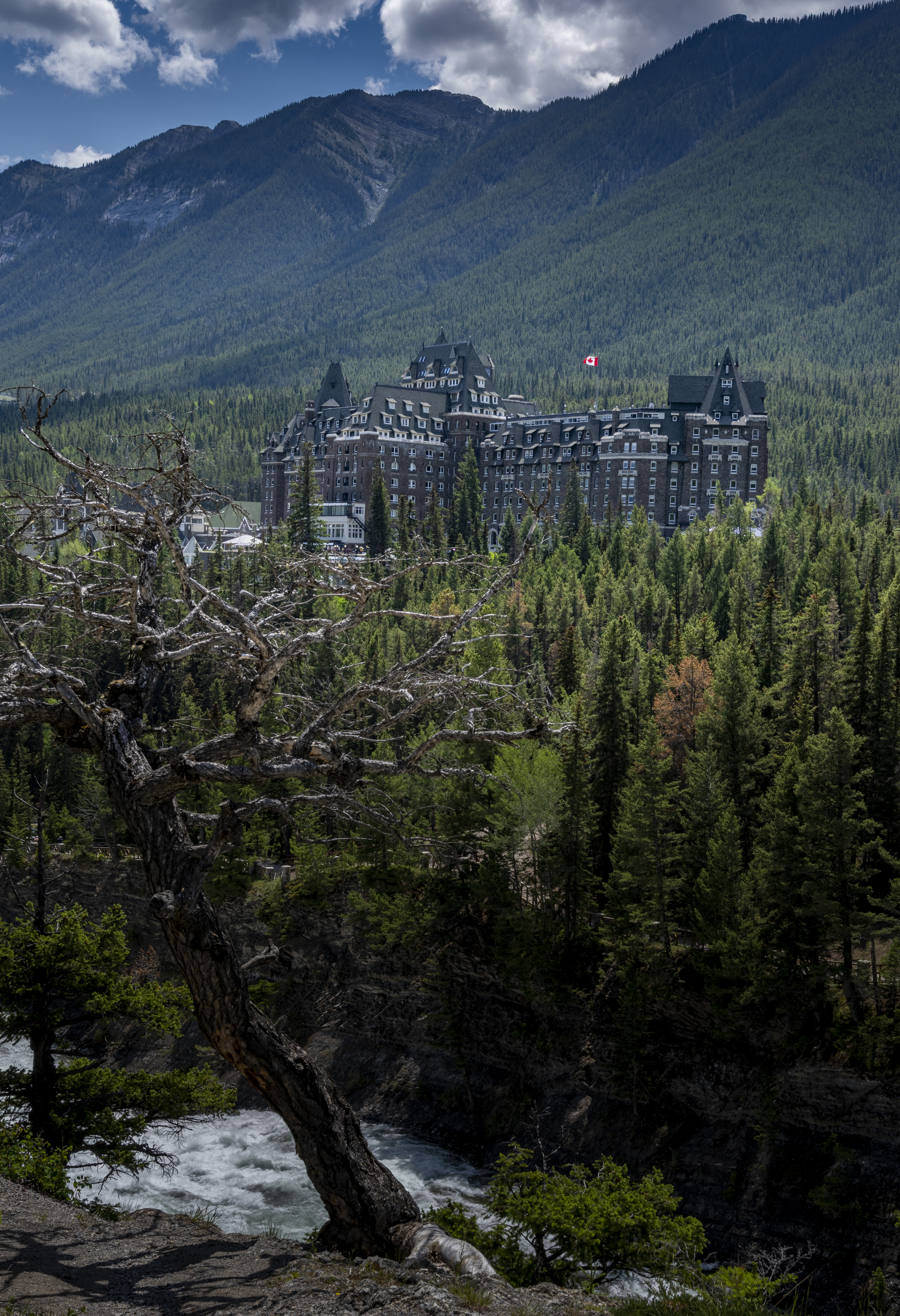
The Banff Springs Hotel stands out as the architectural marvel that it is. Construction started in the early 1900’s to promote tourism, and attract visitors to the natural springs in the area (originally discovered and used by First Nations people centuries before). Perched on the slopes of Sulphur Mountain, the hotel offers stunning views of the Bow River as it snakes its way around Tunnel Mountain towards Canmore. The best spot to view or photograph the hotel is from Surprise Corner. This is definitely an early morning, or late evening shot (especially when the lights come on in the hotel).
Have lunch on the patio of the hotel overlooking the river for jaw-dropping views and afterwards, head down to the Bow River Falls a short drive away. The view down the valley is definitely picture worthy.
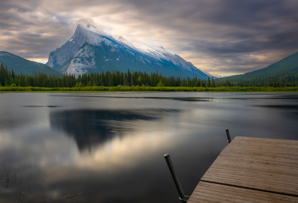
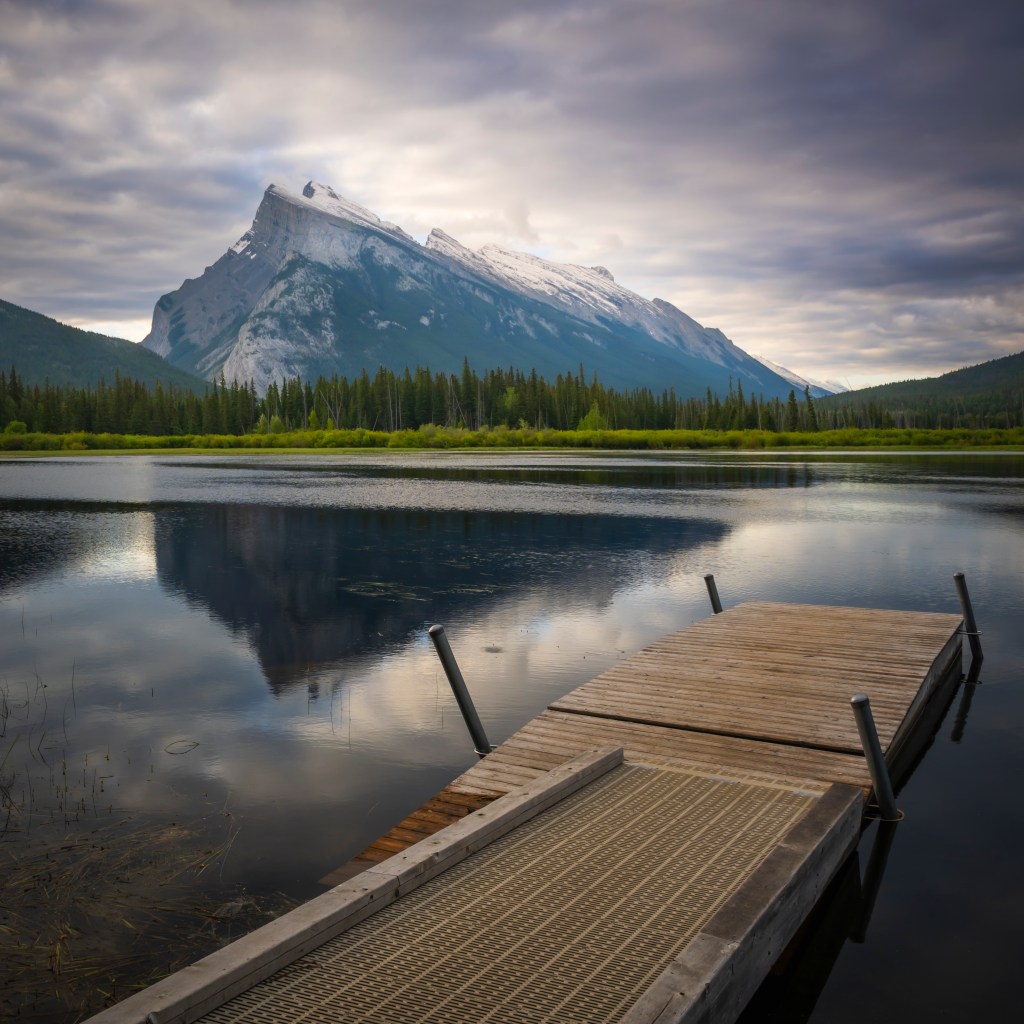
Vermillion Lakes
Vermillion Lakes are located just outside the town of Banff and offer easy access to a very popular location for photography. The site offers views of Mount Rundle and, depending on the weather, you can get some nice reflections of the mountain in the water. Sunrise is best for this location and hopefully the lighting gods will favor you with great light reflecting off of great clouds. I was not so fortunate, but did the best with what I was offered. Don’t neglect this location in the winter as it can offer some great compositions with the snow and ice (especially if there is a hole in the ice). Besides sunrise in the winter is at a much more reasonable hour of the day!
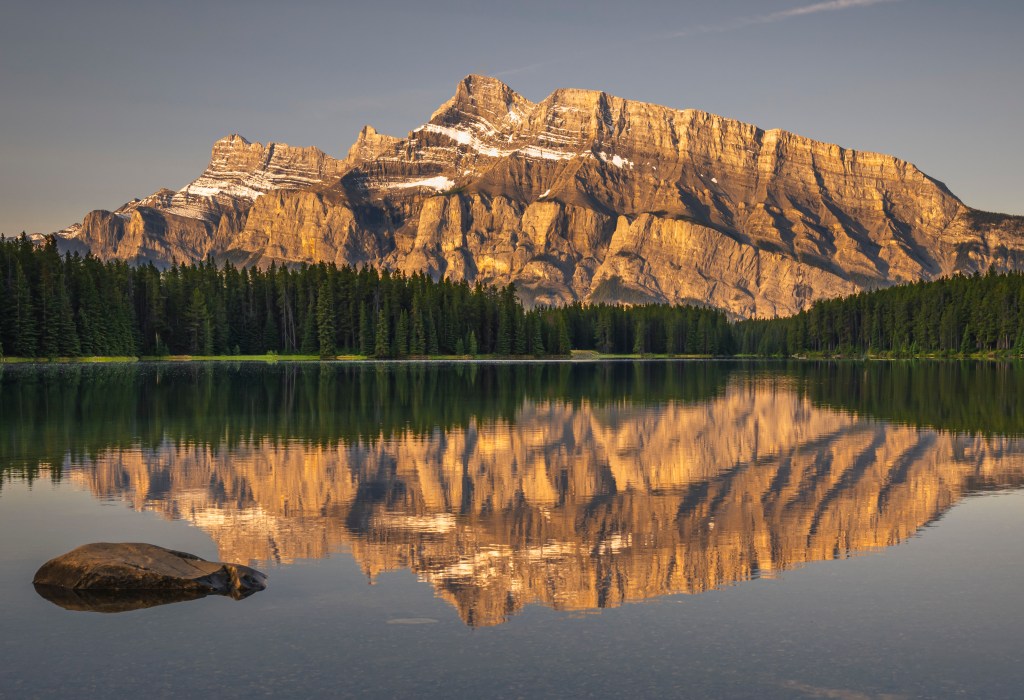
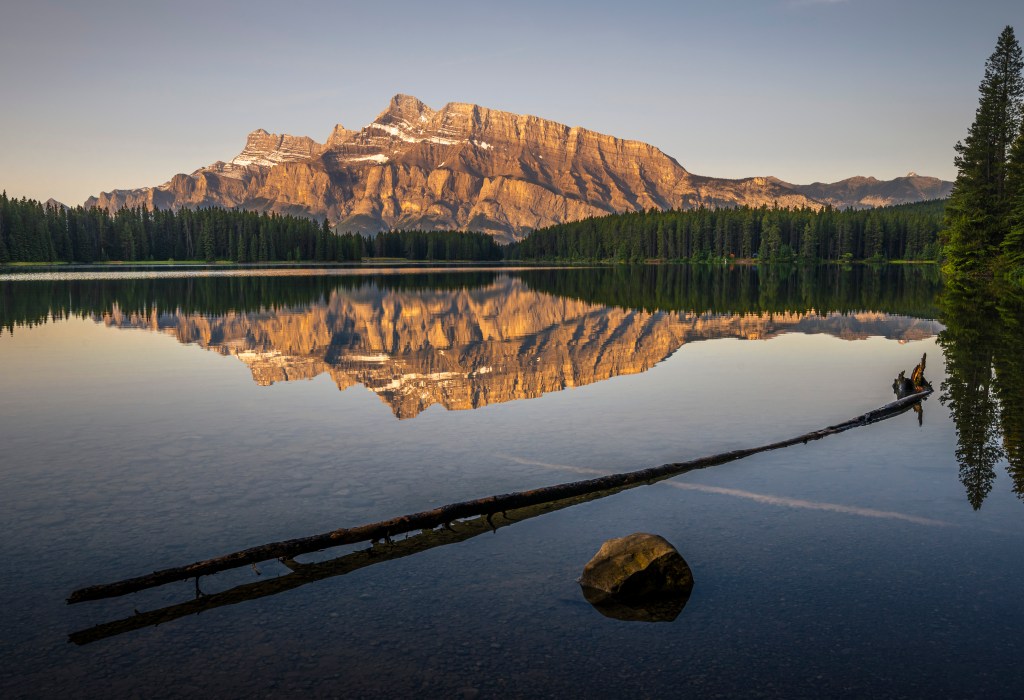
Two Jack Lake
Two Jack Lake is a very scenic location about a ten minute drive from Banff city center, and it offers, in my opinion, even better views of Mount Rundle, especially during sunrise. My favorite location just because I like saying ‘Two Jack Lake’!

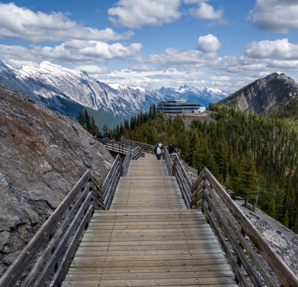
Sulphur Mountain
Take the 6 minute gondola ride up Sulphur Mountain for expansive views of Banff National Park (and beyond). The gondola can get busy, so it is best to reserve in advance. If you are really adventurous you can also hike up, and down the mountain. Be sure to pack your heaviest tripod, since you don’t want the hike to be too easy. The gondola wheel house (where you arrive at the top) features a couple of restaurants (and bathrooms thankfully) and a wrap around balcony to take in the views. There is a wooden boardwalk along the ridge line that offer views on either side, and eventually ends up at the cosmic ray observatory on Sanson’s Peak (not more than 1.5km). If you are really adventurous you can book your time to coincide with sunrise, check it out here.

The Bow River Parkway
The fastest way to get to Lake Louise from Banff is to take the Trans-Canada Hwy, which is still spectacular, but I would recommend you take the Bow River Parkway which runs adjacent to the T-Can. The Bow River Parkway offers numerous picturesque photo ops and the chance to see wildlife along the way.
If you are enjoying this post and would like to get notifications about future posts, subscribe here.
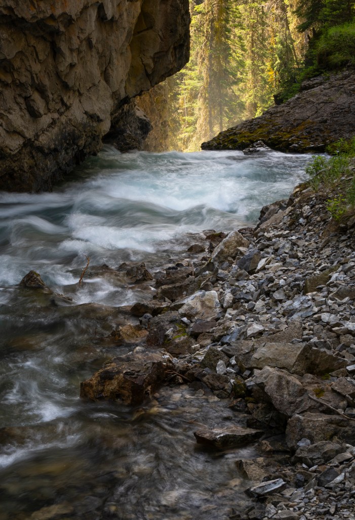
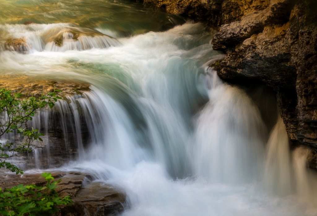
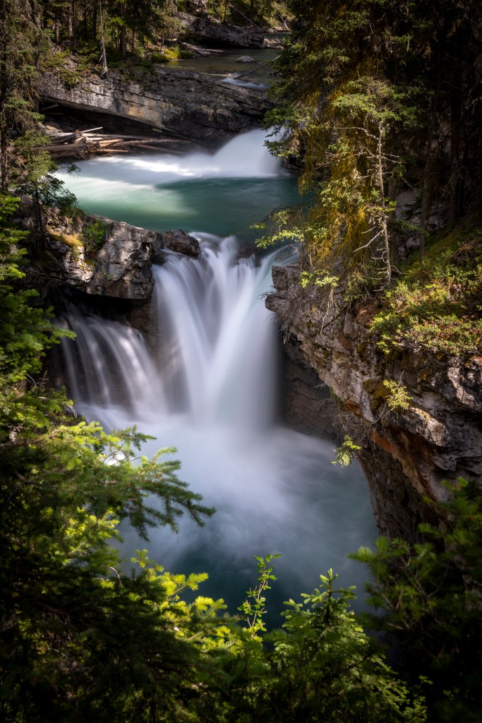
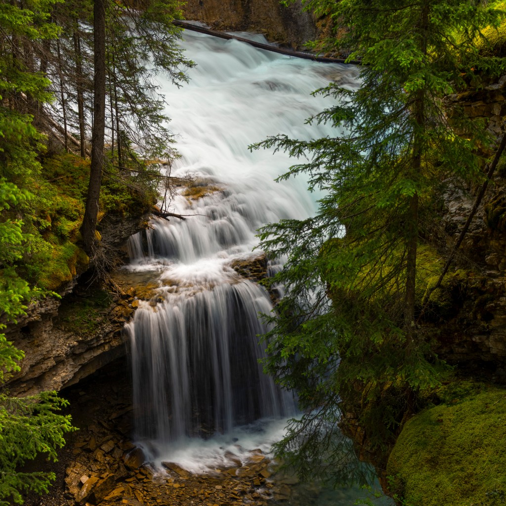
Johnston Canyon
Johnston Canyon is a must stop along the Parkway, but I would recommend you get there early as the parking lot (and path) can get very crowded. It would be ideal if you can get there around sunrise, canyon lighting can be very harsh from mid-morning to mid-afternoon if the skies are clear (as was the case during my visit); there can be a lot of deep shadows with very bright spots in your compositions (we arrived at 9:30 and it was already too late). The hike itself is about 2.5km one way with a moderate elevation gain; the path is well manicured and maintained with a lot of sections on boardwalk extending over the river. You will want to bring a tripod for those long exposures, but be warned there are a lot of railings you will need to deal with (issues with tripods). I ended up draping two legs of my tripod over the railings to get better compositions, but I did have to wait for people to pass by due to vibrations in the boardwalk.
The highlight of the hike is the waterfall at the end. There was about a ten minute line up to see the falls, which was not too bad. I suspect if you arrive later, the line up can get very long. Given the line up and lack of space, finding a composition was a real challenge and because of the boardwalk you can’t really get a clear view of the falls. So not an epic waterfall location. The water on the other hand is just simply gorgeous, clear and emerald. Imagine all that water, eventually merging with the Bow River, which eventually ends up in Hudson’s bay – amazing.

Morant’s Curve
In the 1930’s, CP Rail established a number of luxury hotels across Canada in order to promote tourism, and ultimately traffic for their passenger rail business. Some great examples are the Chateau Frontenac in Quebec City, the Chateau Laurier in Ottawa, the Banff Springs Hotel in Banff, and the Lake Louise Hotel. In order to promote this tourism they hired photographer Nicholas Morant to photograph the Canadian Rockies. His iconic photo of the Bow River valley, surrounded by the mountains and with the rail line and river in the foreground, is simply a classic. There is a viewpoint which is just off of the Parkway and when we arrived late mid-afternoon, I really thought the lighting was not very good. I did go back a few days later, during the morning but found the lighting completely flat and featureless. I took a bunch of pictures but in post processing realized that the original shot was gold.
For completeness one should wait for a train to arrive from the right, catching the engine and cars at just the right moment. However train schedules are not published and so we ended up waiting for about an hour to see if a train would pass by, but no such luck. I do love this shot, the light is so soft and golden, probably because of the clouds moderating the sunshine.

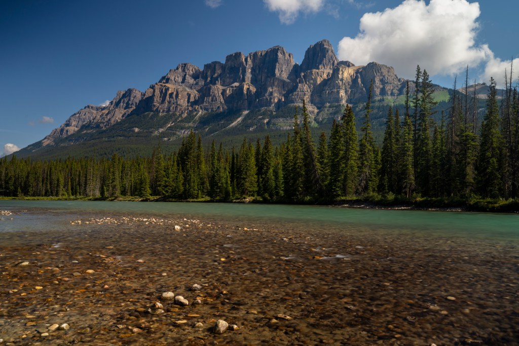
Castle Mountain
Another great location along the Bow River Parkway is Castle Mountain, (Google Castle Mountain Viewpoint). There is a car park on the opposite side of the viewpoint. To reach this location you will need to open the wildlife gate (please close it after you pass through to prevent animals from escaping and heading onto the highway) and head down to the rivers edge. This would be a great sunset location and works equally well in the summer or winter.
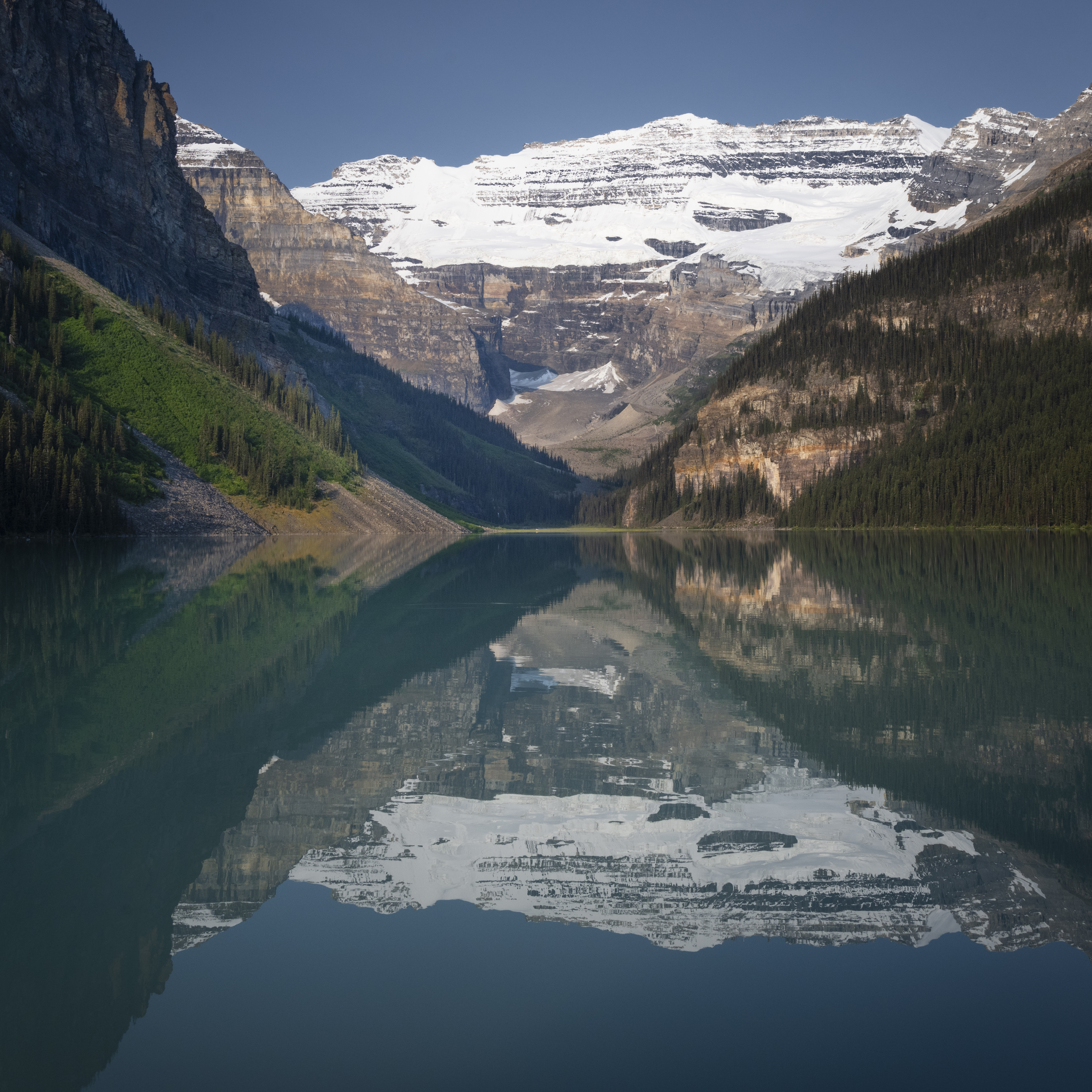
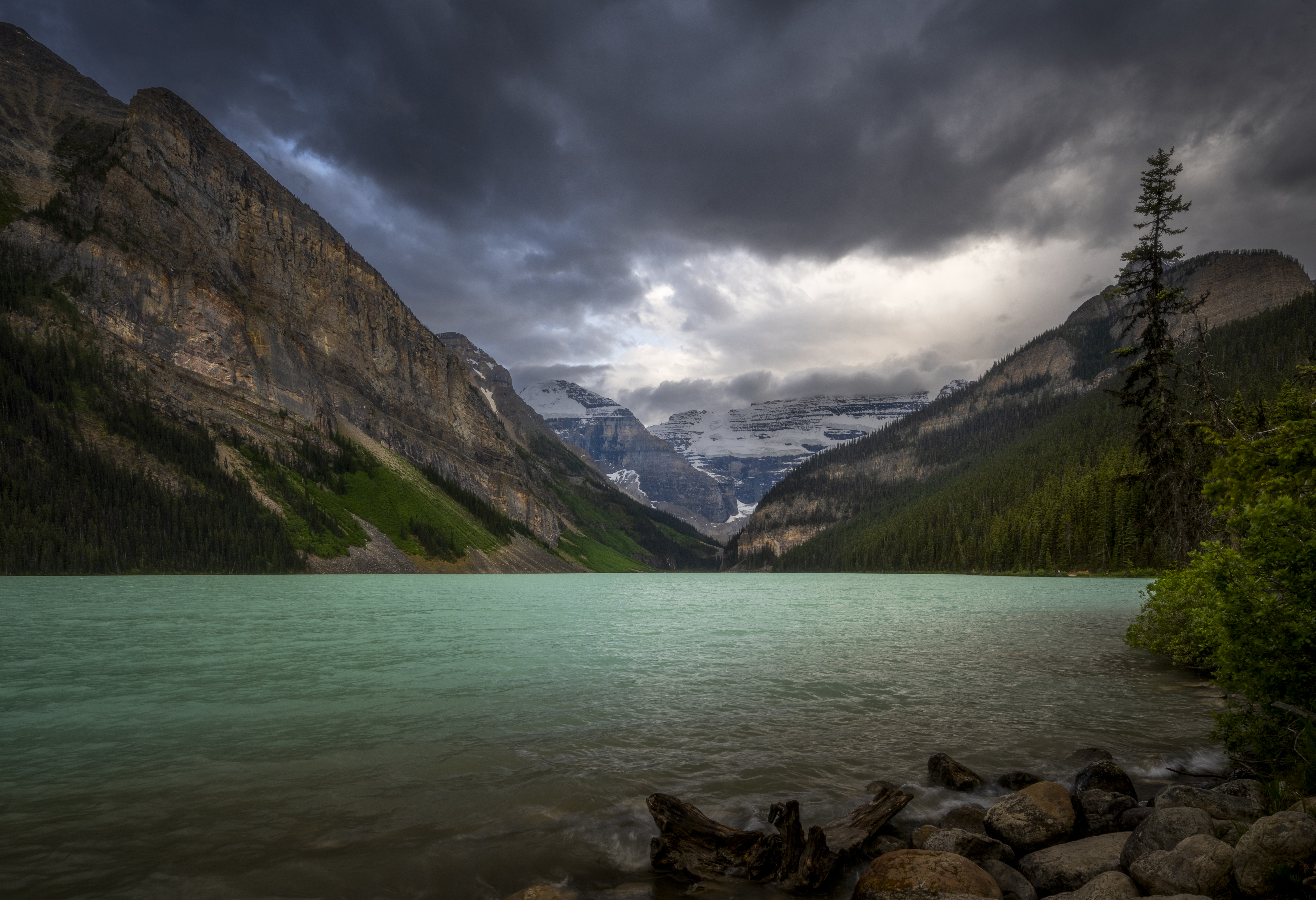
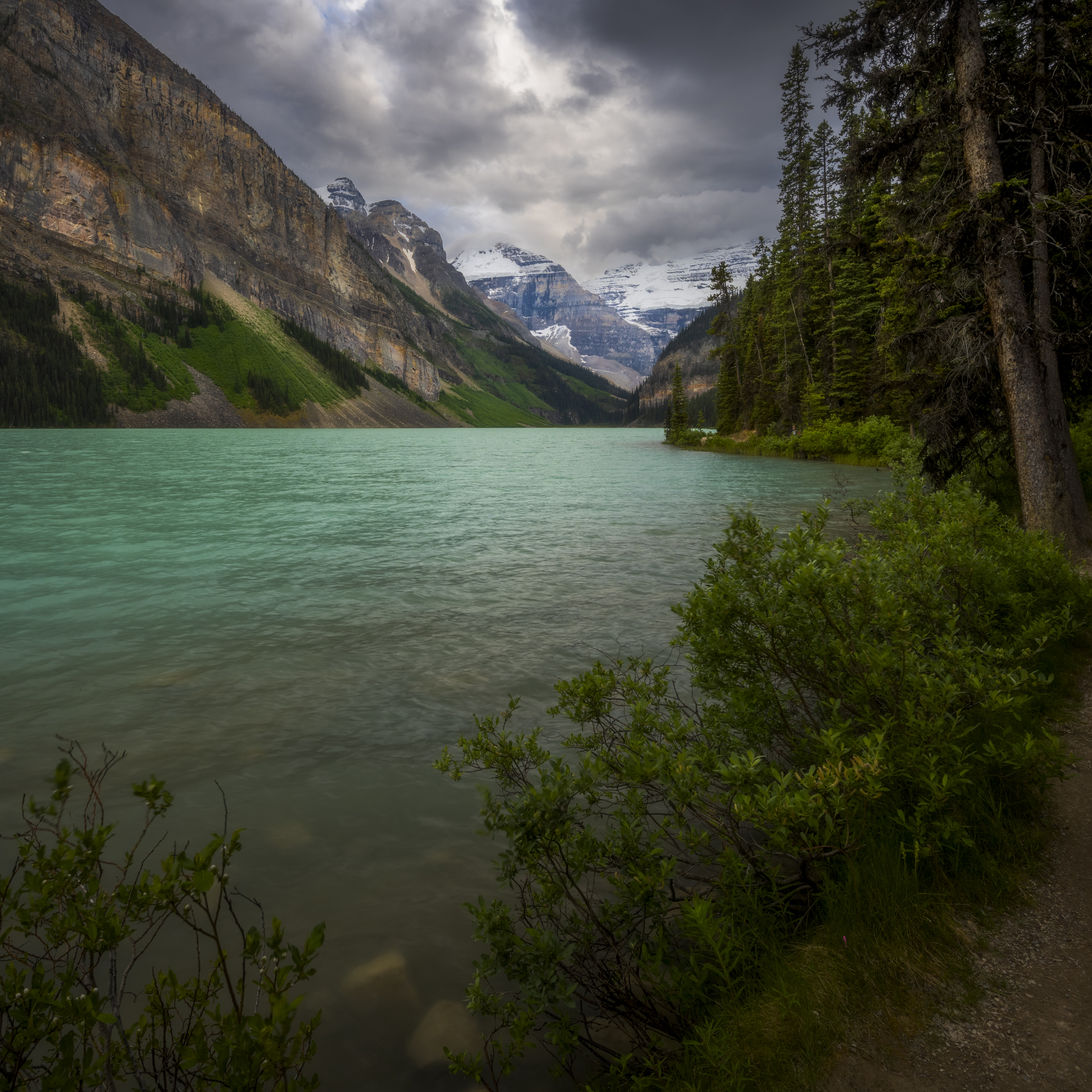
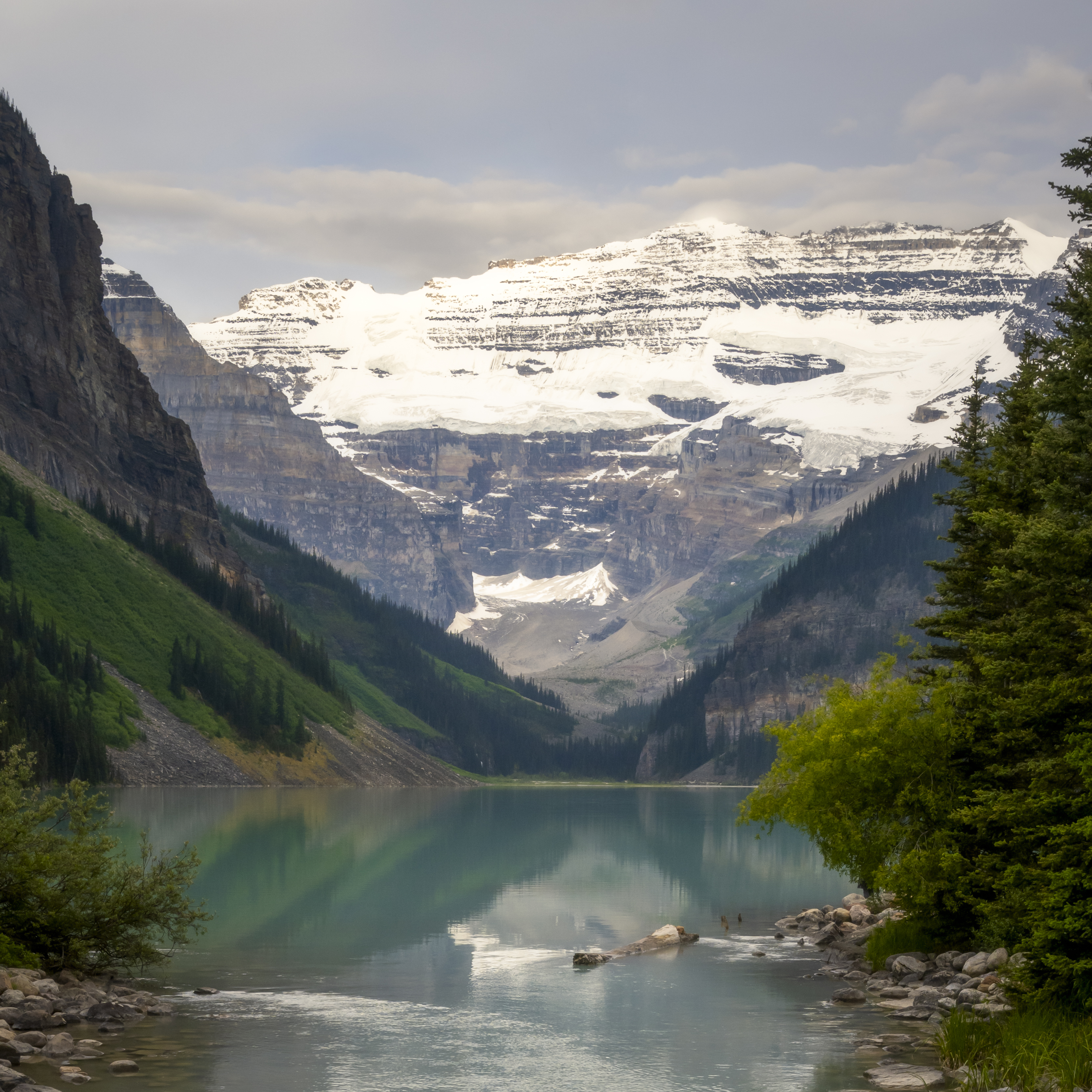
Lake Louise
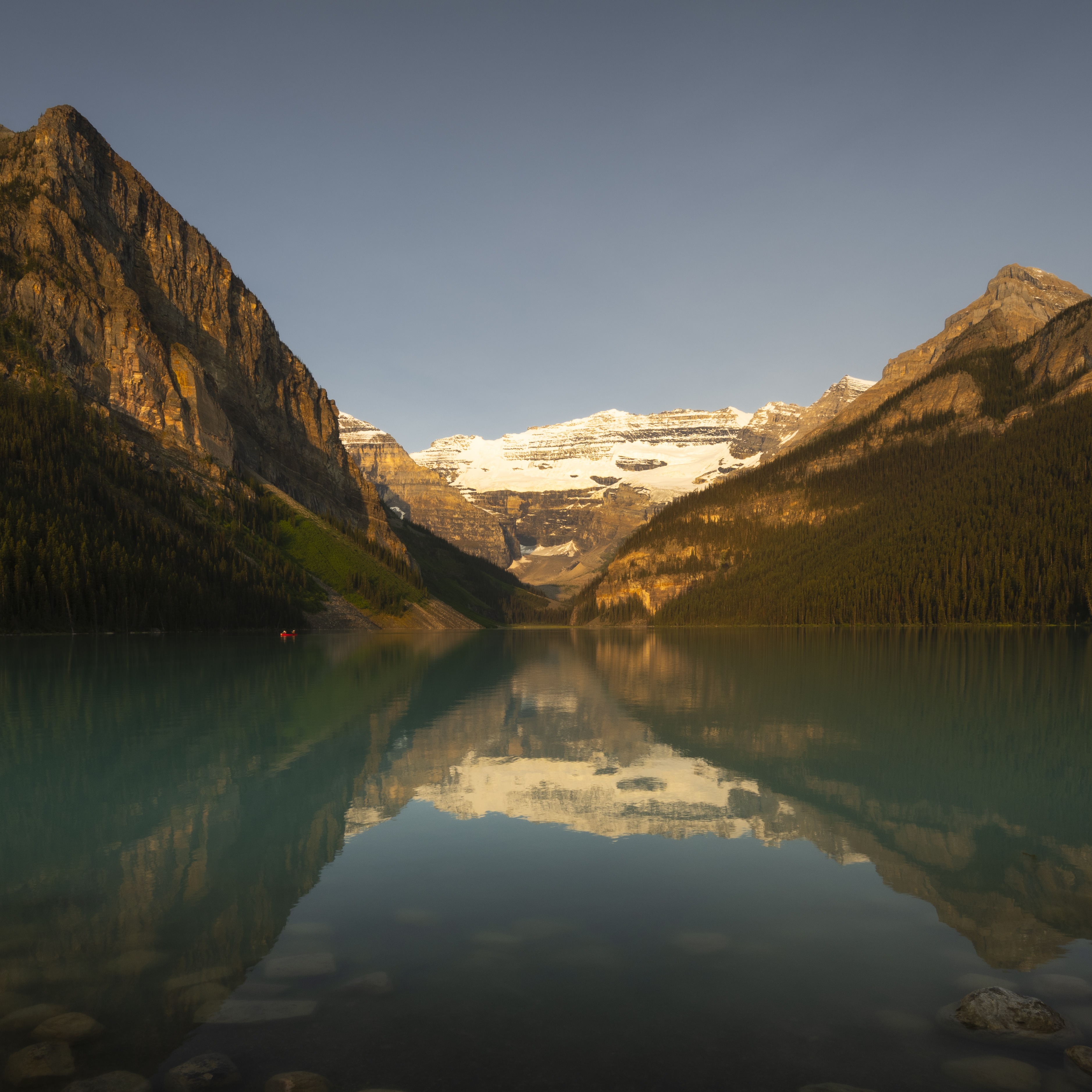
Lake Louise is simply mesmerizing, the way the view recedes to the mountains in the back, and is bordered by the slopes on either side; the foreground is the emerald green and mirror flat water surface reflecting the gorgeous view, I could stare at it all day. The tiny town of Lake Louise is some 3kms away from the lake itself and was established in the 1880’s as an outpost of the Canadian Pacific Railway. At an elevation of 1,600m it is Canada’s highest elevation community with a registered population of only 691 people. Of course tourists add considerably to that figure.
In the Stony Language of the Nakoda, who were the original habitants of these lands, the lake was called Ho-run-num-nay, or ‘Lake of the Little Fishes’. Since Lake Louise is at such a high altitude it ‘enjoys’ a sub-arctic climate with summer average highs in the low 20’s C, while average temperatures in January and February are a bone chilling -20 degrees C. For morning shoots I had on a couple of thermal layers, as the temperature started close to zero degrees, but warmed up nicely through the course of the morning.
Photography
Given the incredible landscape there are no bad images of Lake Louise, but as photographers we are always looking for the extra-ordinary, something special, something to stand out, and given the popularity of this location, it is a real challenge.
My recommendation is to explore both sides of the lake as the views constantly change. When we arrived, the weather which had been clear and cloudless, was now very dynamic with wind and clouds passing through as shown in the first gallery photo below. There was no longer a glass surface to the lake as the wind had picked up substantially making a wavy lake surface. The RHS side of the lake offered many different compositions, including some interesting foreground elements and perhaps a view that you have not seen on Instagram.
The next morning things had settled down and the water was calm but the skies were still cloudy, so no chance of a sunrise shot (which by the way if you can catch it, is spectacular). By our third day the skies had cleared completely and the sun was shining through on a mirror-like lake surface. How many days do you need to stay there to get those ideal conditions; a clear and pink sunrise casting beautiful light on the mountains and fluffy clouds in the background.
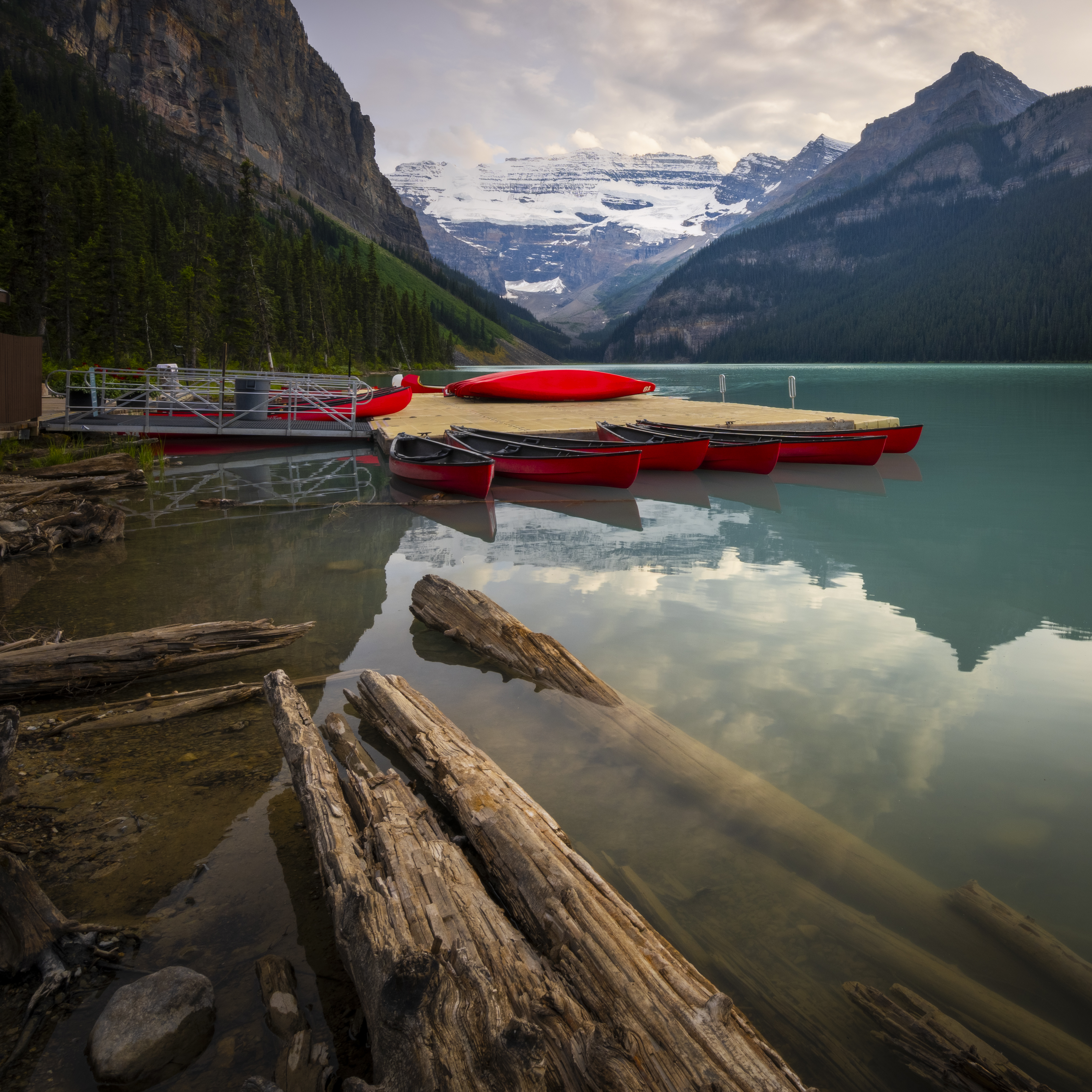
The LHS of the lake offers some different elements including the canoe house and dock. What can be more Canadian than that!
If you are enjoying this post and would like to get notifications about future posts, subscribe here.
The IceFields Parkway
Described as one of the most spectacular highways in the world, the Icefields Parkway connects Lake Louise to the town of Jasper some 233km north. We managed to travel the Parkway all the way to the Columbia Ice Fields, before having to turn back due to time constraints. That distance was only 130 km and would normally take 90 minutes to drive straight through. But we were touring and with all the stops and mini-hikes we ended up taking a full six hours just to get to the Columbia ice fields. So, leave plenty of time for the drive, you will not regret it.
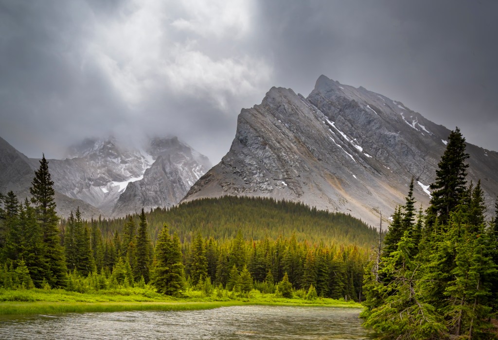
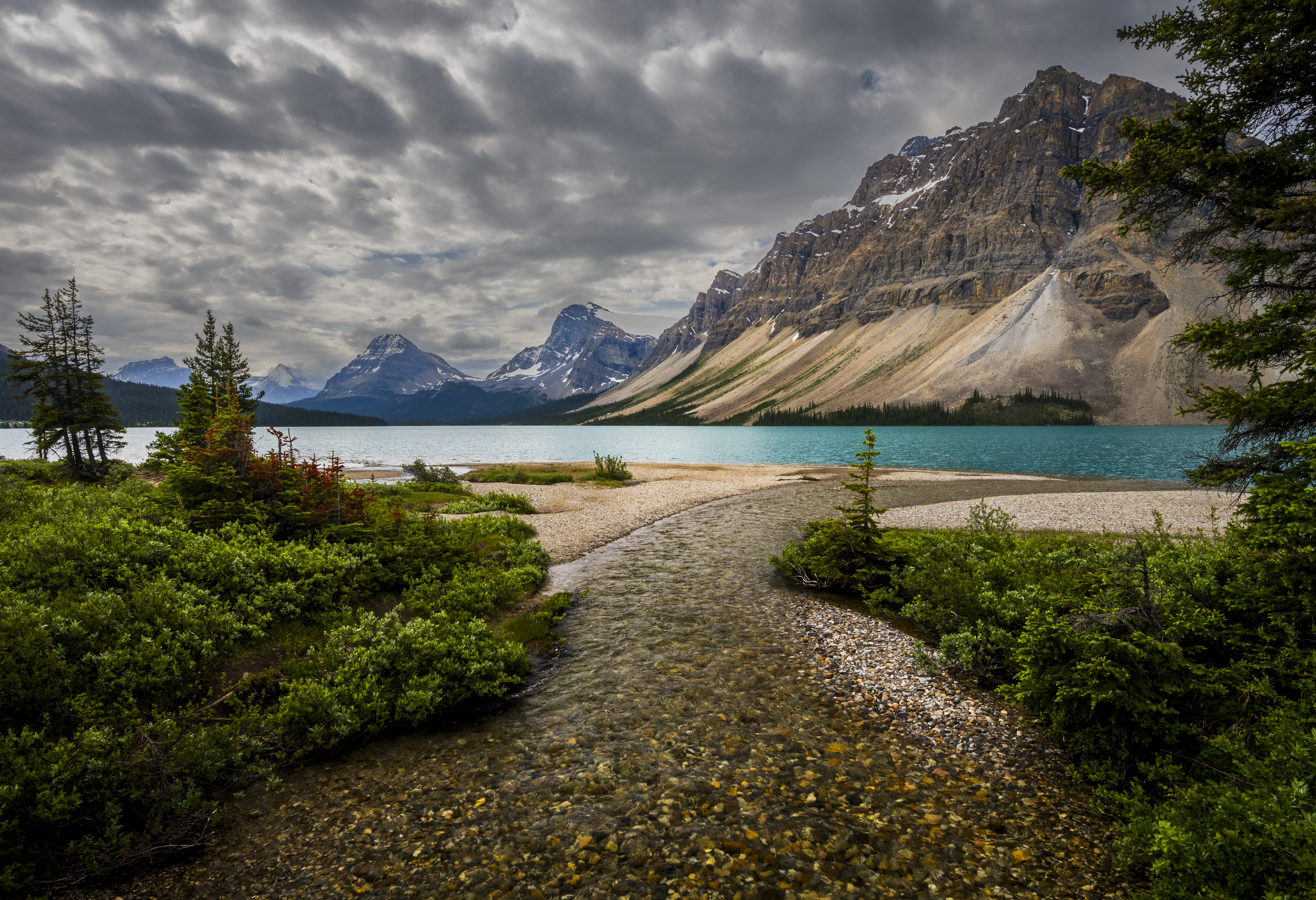
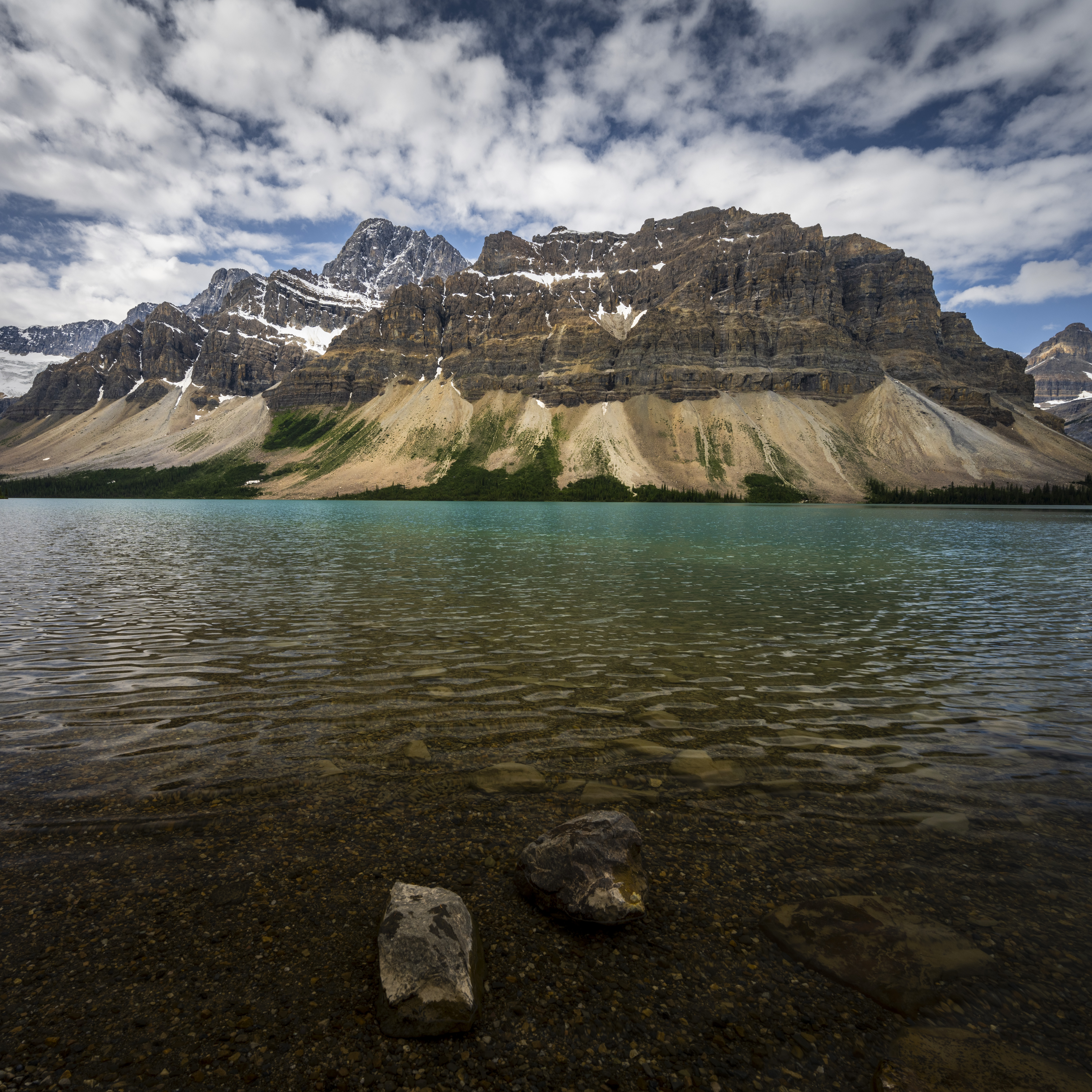
Bow Lake
This is where it all starts, the origin of the Bow River. Fed by the melting ice of the Bow Glacier, part of the Wapta Icefields, Bow Lake is one of the largest lakes in Banff National Park and is the starting point for the Bow River. There are just so many spots for compositions, you can easily spend hours here taking different pictures and if you have the time you should hike around the lake to the Bow Falls, which is a 6km round trip. If you are really adventurous you can sign up for a hike on the glacier itself (when I was scanning with my 400mm lens I could just make out a line of human silhouettes on the glacier – what an experience)!

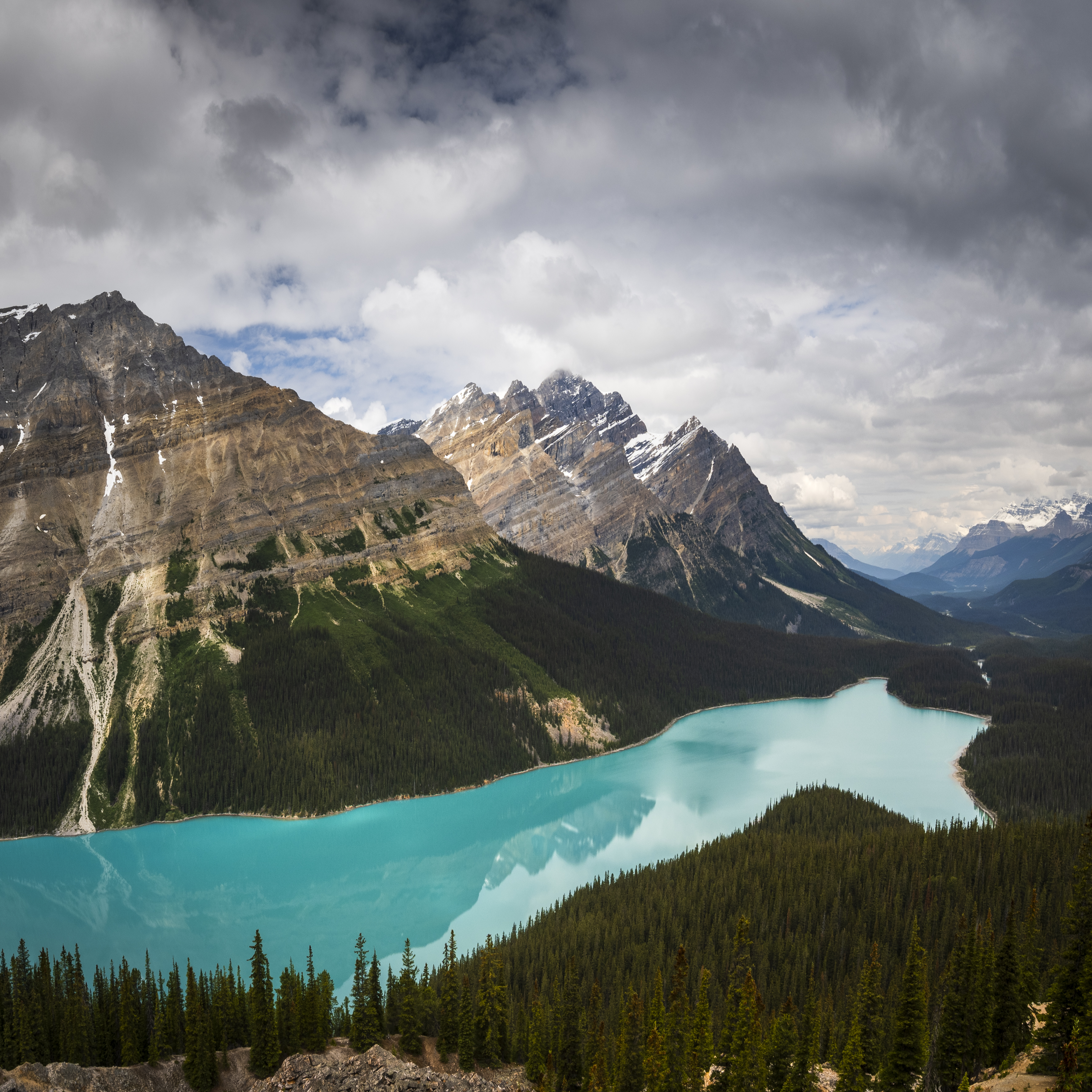
Peyto Lake
A must do stop along the Icefields Parkway is the short diversion to Peyto Lake. From the car park it is a 600 meter moderate climb to the outlook over the lake and glacier. During the spring and summer rock flour from the glacier gives the lake its amazing emerald hue. From here the waters flow into the Mistaya River (which flows West as opposed to the Bow River, which flows towards the East), eventually joining the Saskatchewan River in the valley below. Ultimately all this water meets the waters of the Pacific Ocean.
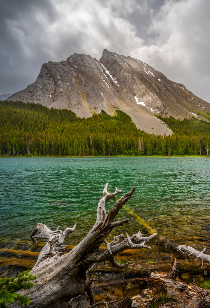
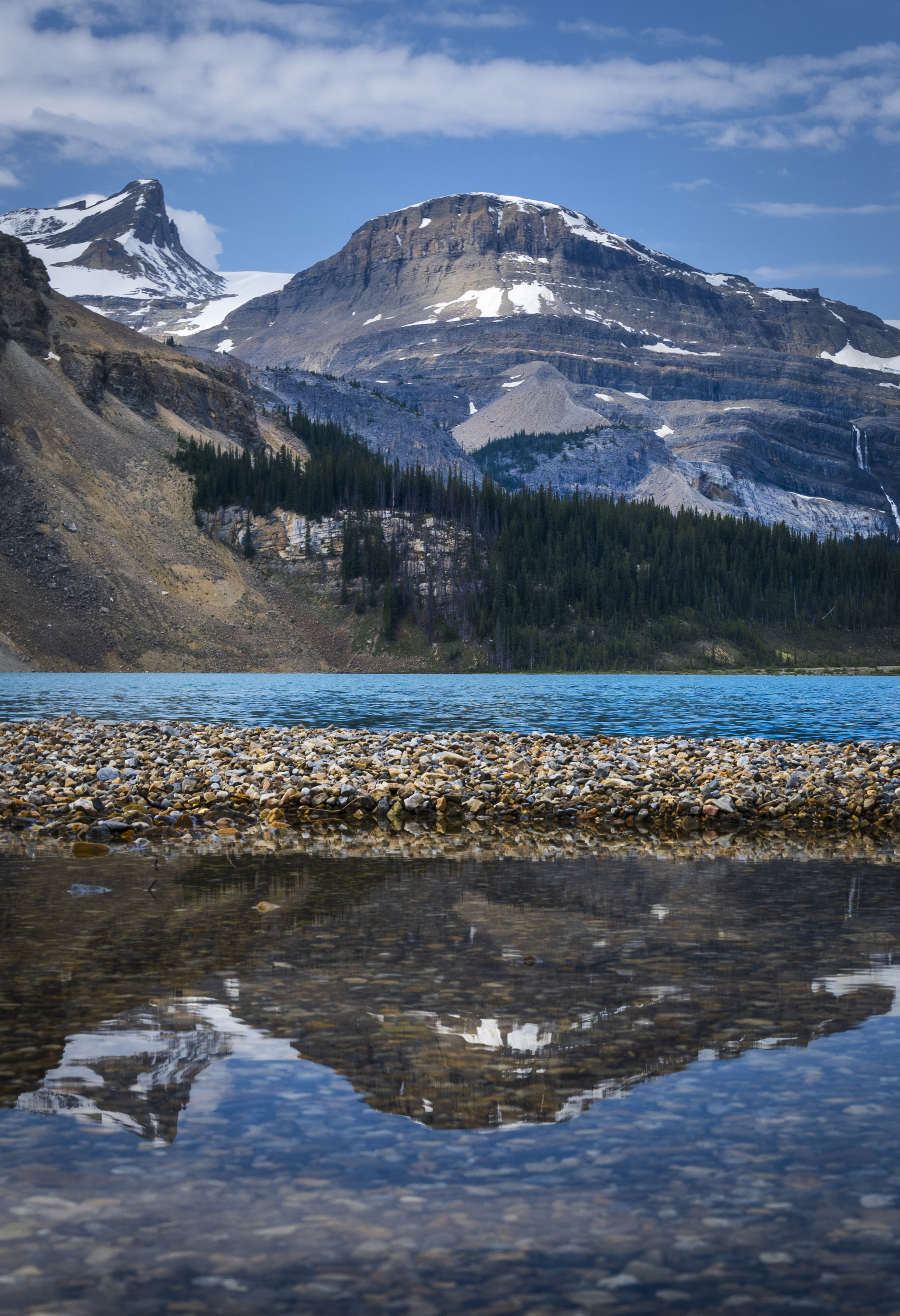
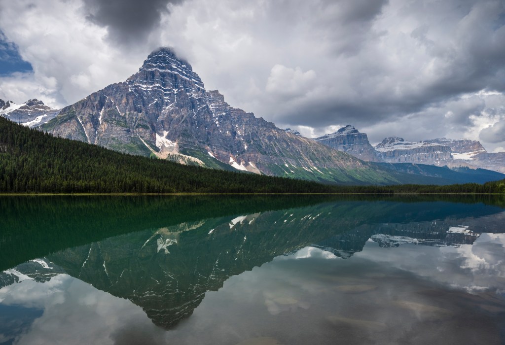
Waterfowl Lake
A very nice and picturesque spot to stop is Waterfowl Lakes. The composition is of an emerald green lake with the mountains in the background.
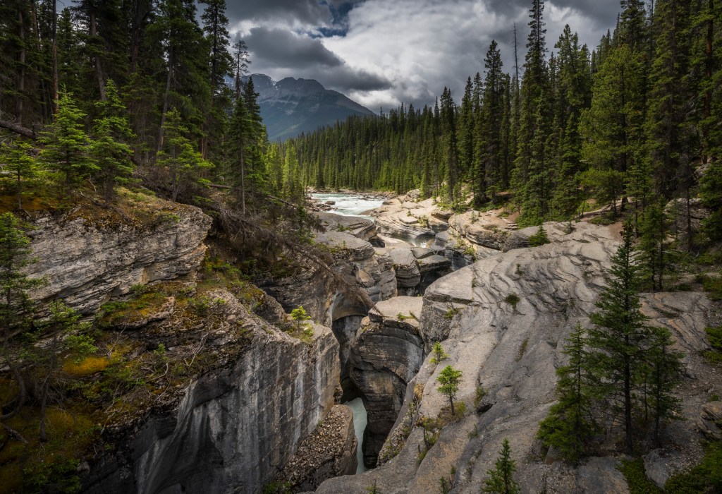
Mistaya Canyon
After leaving Waterfowl Lakes the drive continues towards the Saskatchewan River Crossing and not too far along the way is the stop for the Mistaya Canyon, formed by the Mistaya River grinding into the softer sandstone forming a canyon. In the grand scale of canyons, Mistaya leaves a little to the imagination, but where it shines is the river itself, the rocky shores and the majestic mountains in the background. This is tripod territory for those longer exposures of the raging water. But be careful, we saw so many people going for the Instagram selfie while standing on the very edge of the canyon (and with little kids no less).

Big Bend
Once you cross the Saskatchewan River, you are now in Jasper County and from the valley the road climbs, and climbs and climbs as you head to the Columbia Ice Fields. There are many sights along the way, but one of the best is the view from Big Bend. A car park on the right hand side (during ascent) gives you a chance to safely stop and take in the view (and a few pictures) of where you have come from.
Columbia Icefields (Athabasca Glacier)
After big bend, we continued climbing the mountain pass until we reached the Columbia Ice Fields, home to the Athabasca Glacier. The weather had changed drastically, becoming cold, windy and rainy (which apparently is typical of these mountain top passes). We did venture out, under severe threat of severe cold rain at any minute, which did happen. I had time to capture but one image of the location, about 800 meters from the car park (we were completely soaked by the time we got back to the car.). For those less inclined to climb at this altitude, there are tours (with special buses) that you can book. What I found very interesting is that there are signs of the glaciers recession over the decades. Back in the early 1900’s the glacier was actually where the highway is now.
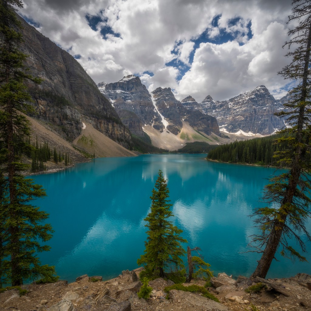
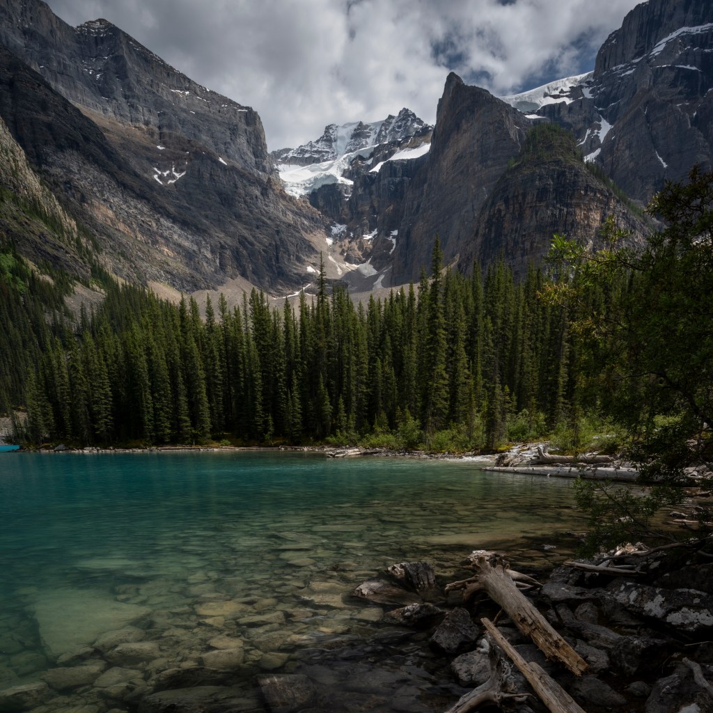
Moraine Lake
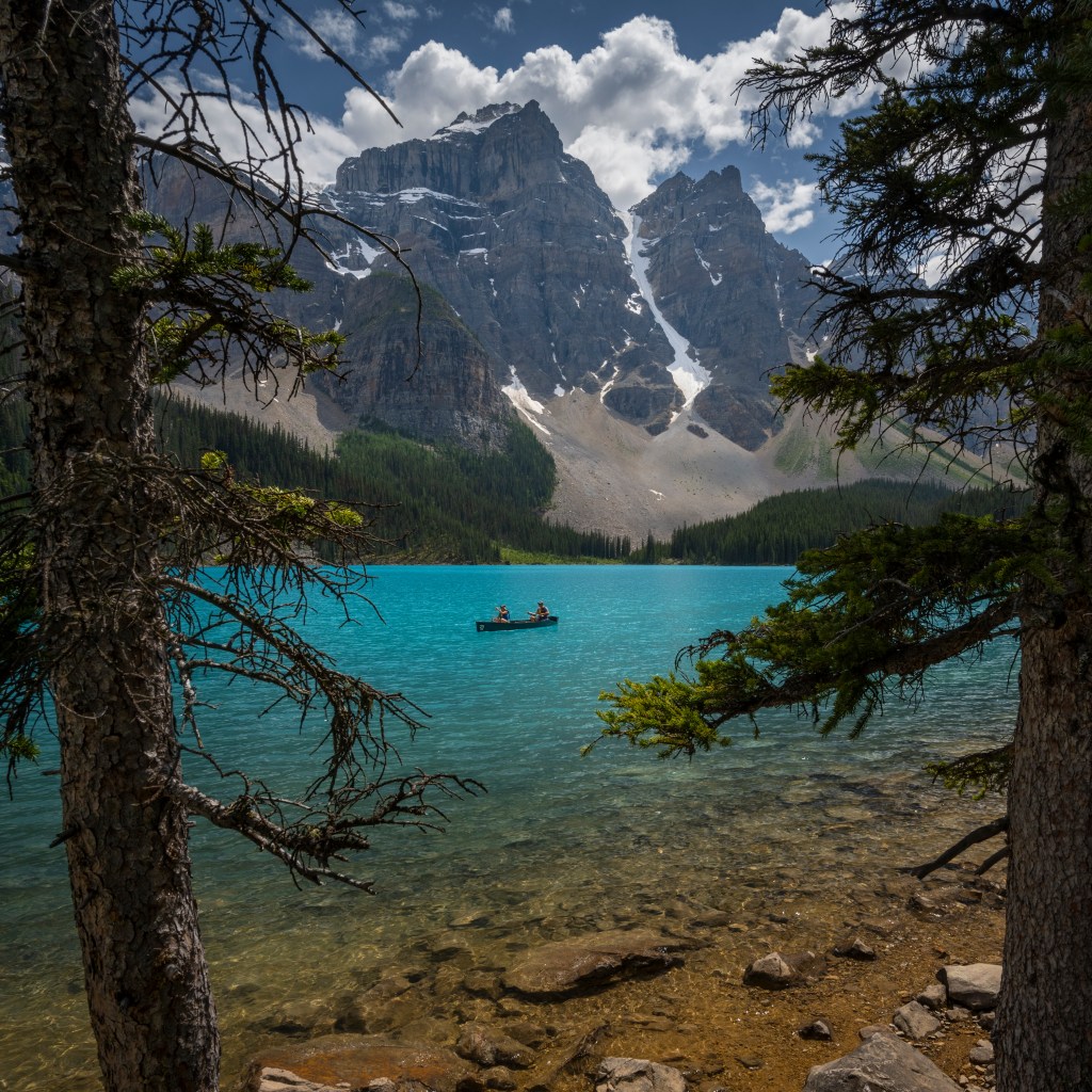
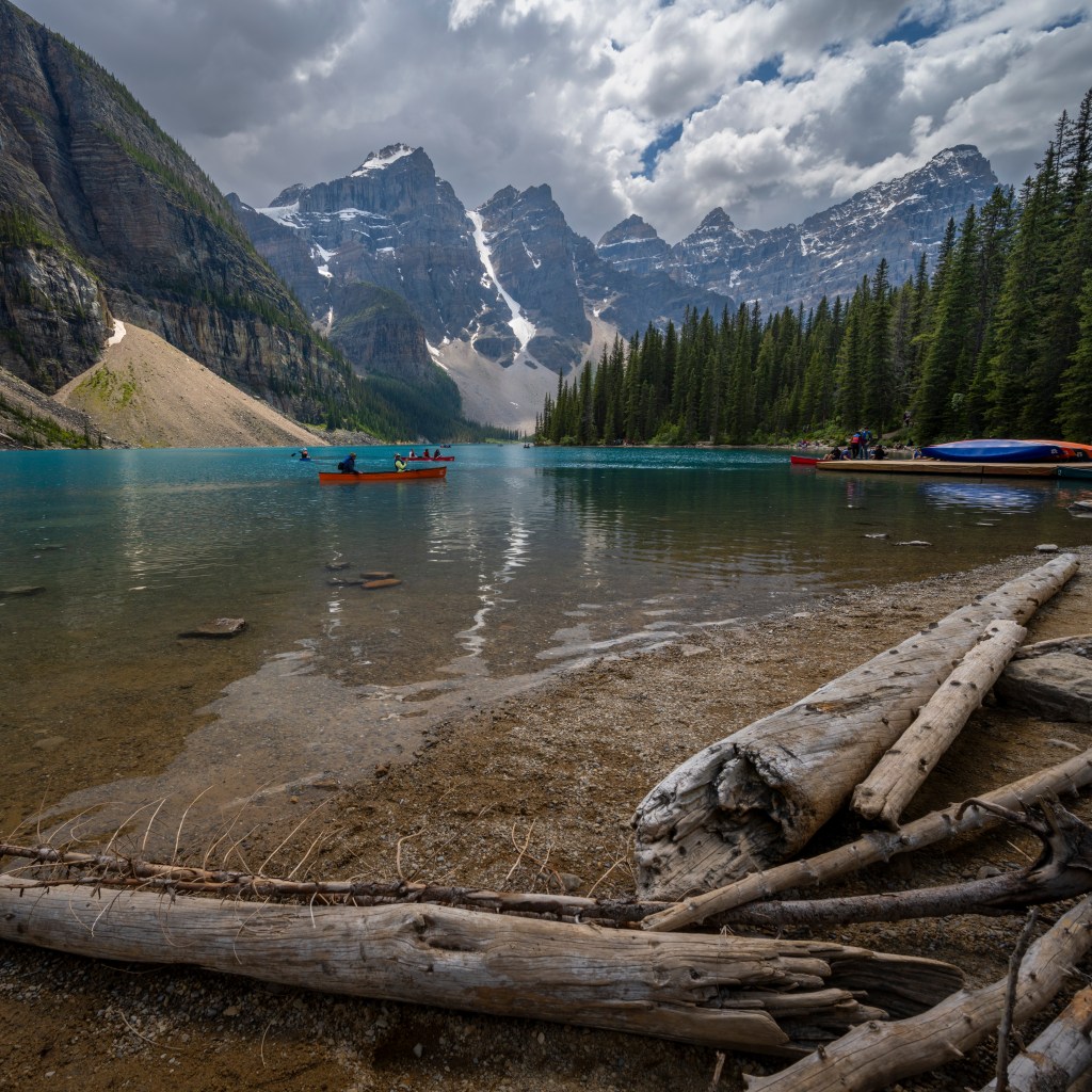
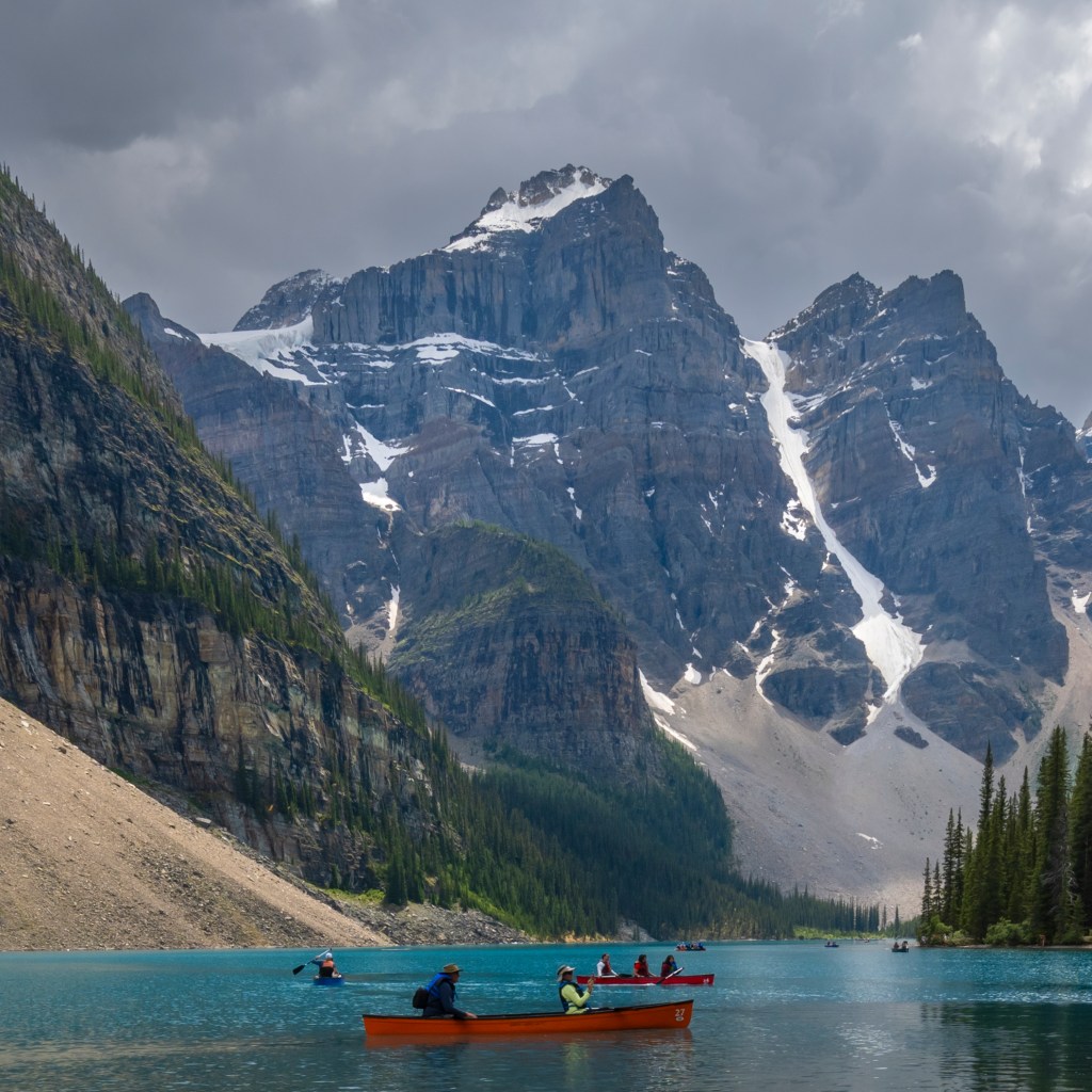
We saved the best for last – while that is true, I am very reluctant to make that statement since this whole trip has been absolutely gorgeous. But I do have to say that Moraine Lake stands out from all the rest. Why is that? Well lets start with the color of the lake and yes there are other lakes equally colorful (Lake Louise and Peyto Lake for example), there is something about the tone and lighting of Moraine that seems to stand out. Second, Moraine Lake is bordered by ten mountain peaks that recede into the distance. Third are the coniferous forest of the surrounding slopes adding some tonal contrast to the rest of the scene. The surface of Moraine Lake is dynamic depending on the wind. At one moment it is mirror like, and ten minutes later it is completely choppy. Early morning and late evening are the best chances to catch the mirror like surface since the air currents are settling down.
You can no longer drive to Moraine Lake since it is so busy. To get there you need to book on one of the many shuttles that leave from Lake Louise (either the town or the lake parking lot). From the shuttle bus drop off park your first destination will be the Rock Pile, literally a pile of rocks that geologists are still debating about its origin (my opinion – it was Disney who secretly owns this location and wanted to create the perfect viewing location, but make it look perfectly natural). When you reach the top it offers a spectacular vantage point to take in the entire view of the lake. The Rock Pile hike is very reasonable at about 1.5km in length and 150 meters in elevation gain. The path is well maintained and flat, but be warned there are steep sections, so take it slow.
Next there is a very reasonable walk/hike on the RHS of the lake offering countless vantage points of the lake and the mountains beyond. This hike /walk is about 4km in length (out and back total) and you will gain new perspectives of the lake and mountains, definitely worth it.


Hope you enjoyed
Hope you enjoyed and found this blog useful. Please contact me if you have any questions, I would be happy to help.

Beautiful pictures of my backyard :) But you’ve mislabeled one picture. What you call Cathedral is actually Castle. Maggie
LikeLike
Thanks, I will make that correction. Such a beautiful part of Canada. Can’t wait to get back
LikeLiked by 1 person